Ronda - Visits and Views
last update: 31 December 2020
"Aquí en Ronda el aire es fuerte y magnifico…
y agrupada sobre una altiplanicie una de las más antiguas
y extrañas ciudades españolas"
Depression of Ronda
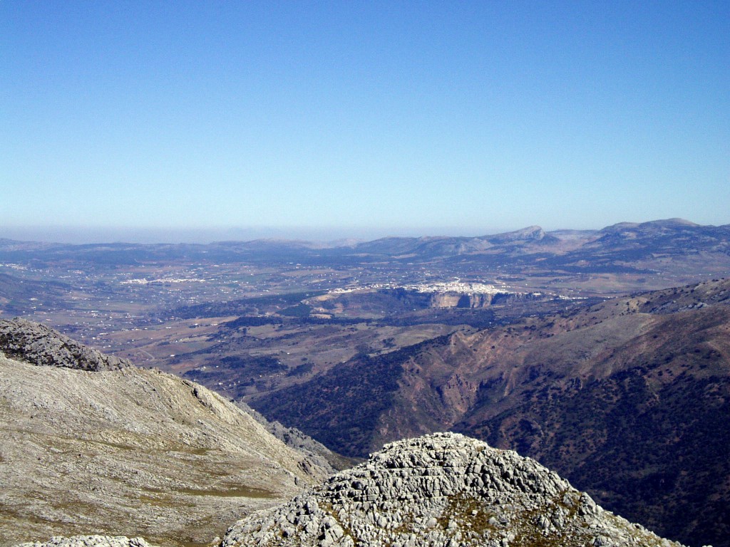
The 'Depression of Ronda' is situated in the very heart of a labyrinth of rough and arid sierras (i.e. mountain ranges), known as the Serranía de Ronda. It is part of a great mountain ridge, that, traversing Spain diagonally, divides the affluents to the Mediterranean from those to the Atlantic.
If we are to understand the cliffs of Ronda, and the magnificent views they accord us over the valleys below, we need to understand what the description above really means. Wikipedia presents the Serranía de Ronda as a 'comarca' (or a kind of 'shire'), but its real identity comes from its geology. We start with the Baetic System (also called Cordilleras Béticas) which is one of the main systems of mountain ranges (sierras) in Spain.
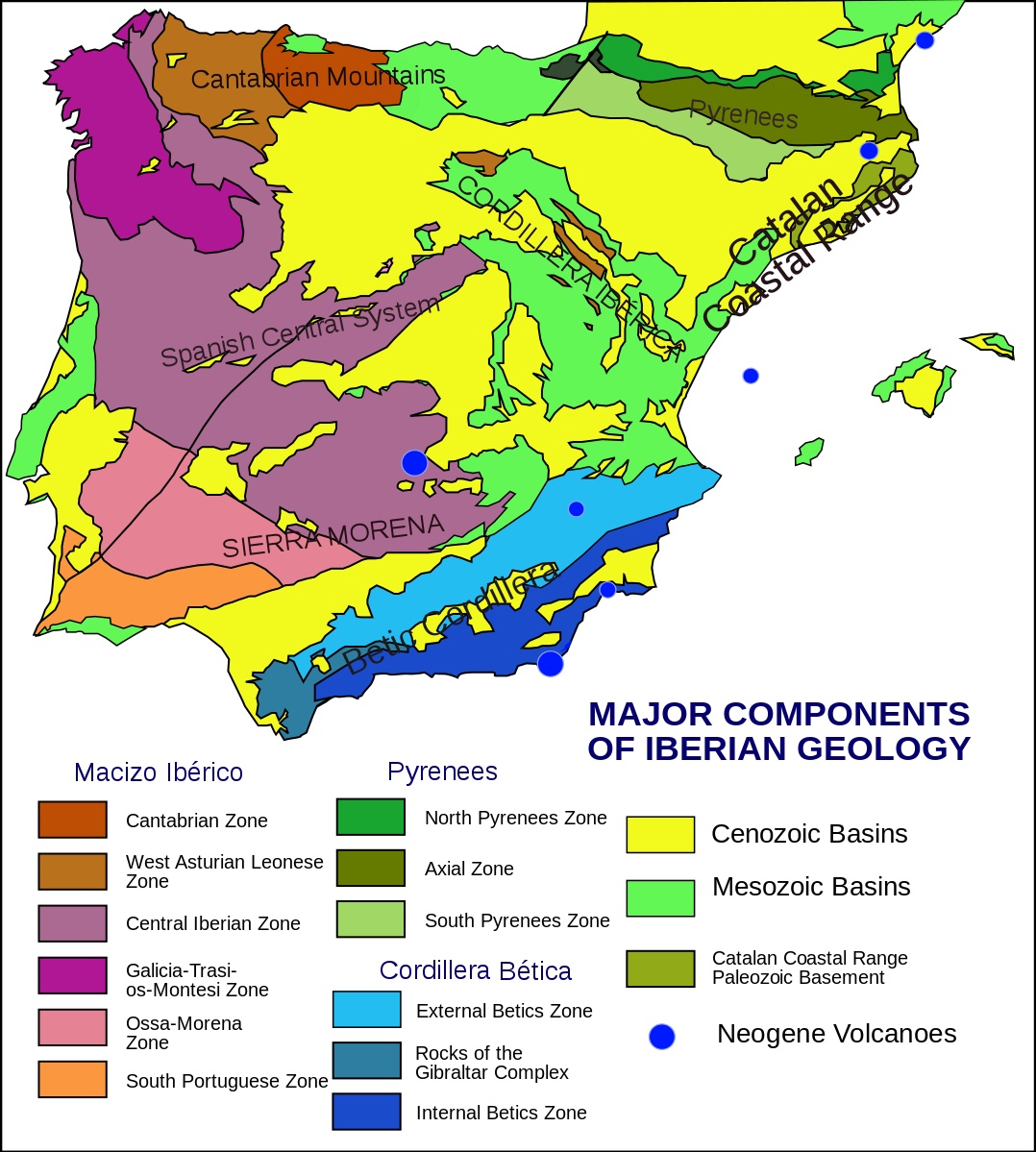
The Cordillera Bética is divided into a series of sub-chains, including the Penibaetic System and the Subbaetic System. The Penibaetic System is home to the Sierra Nevada and the highest point on the peninsula, the Mulhacén at 3,478 m.
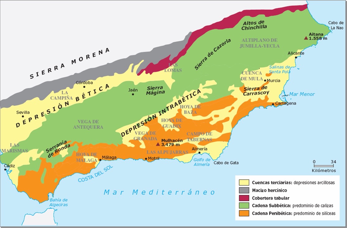
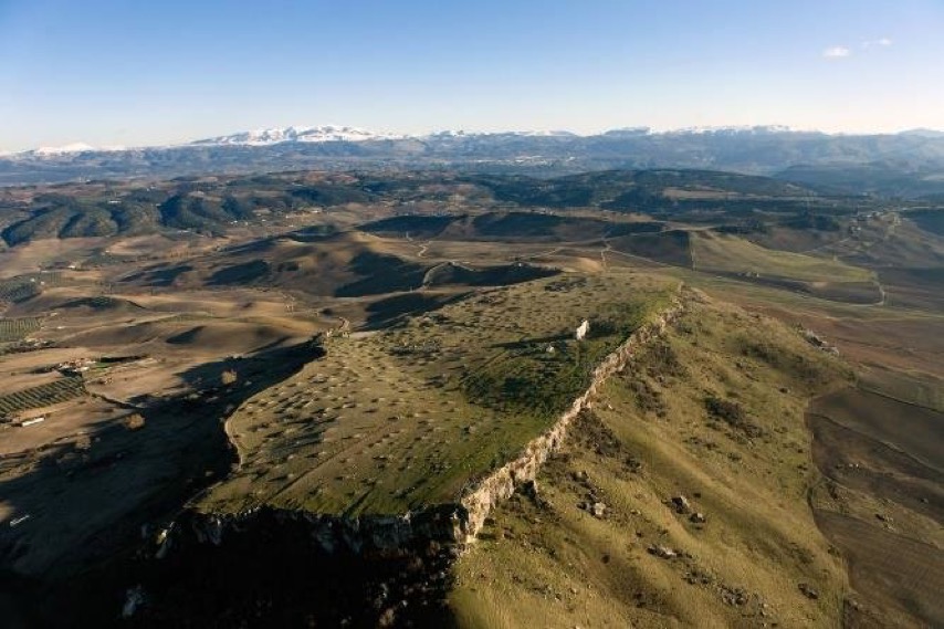
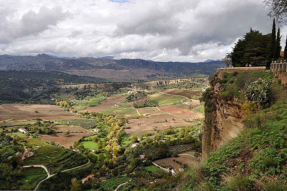
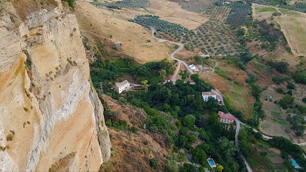
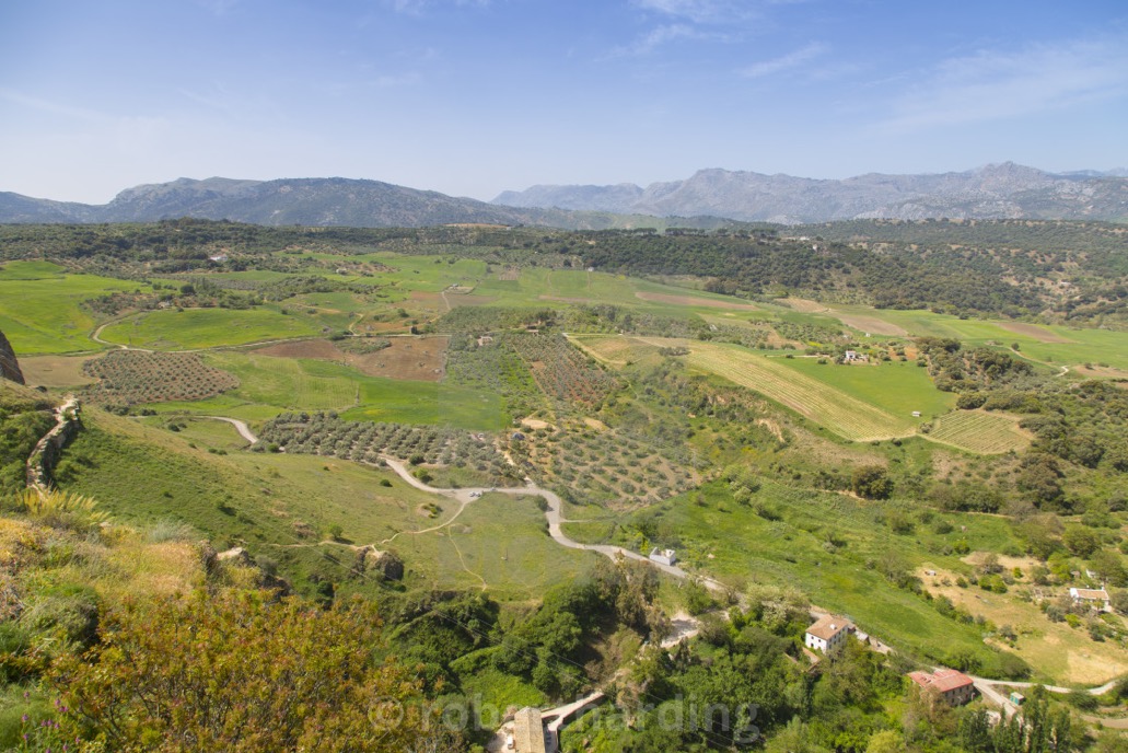
The two sub-chains are separated by a discontinuous series of valleys, called the Intrabaetic Basin (Surco Intrabético). As far as I understand things the underpinning rock was still both brittle and ductile and able to fold producing a chaotic structure of outcrops, faults, depressions, fluvial incisions, etc. The valleys are also called intermontane basins, one of which is called the 'Depression of Ronda'. So it's a kind of sedimentary basin in the form of a plateau surrounded by ridges of the Serranía de Ronda. What we have is a plateau because it's relatively flat and set well above sea level, but at the same time it's a basin because its surrounded by rocky ridges.
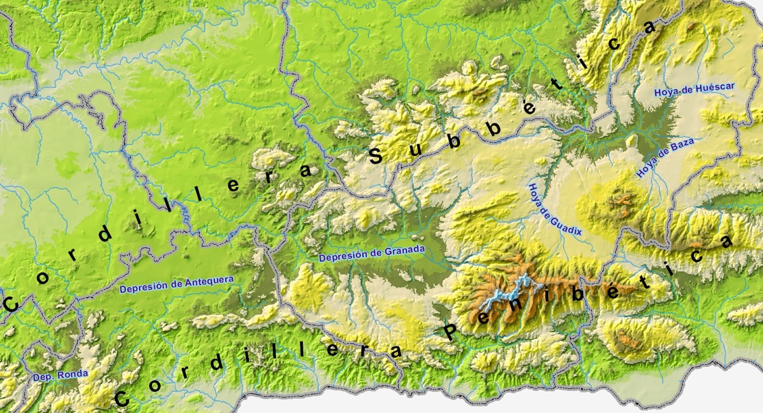
Above we can see the different depressions sitting between the Penibaetic and the Subbaetic systems, including the Depression of Ronda. Today these basins are defined by the surrounding dry, almost treeless mountain ridges. The basins being relatively flat and of a low relief facilitated the accumulation of sedimentary deposits. The Depression of Ronda filled up with clays, dolomites, limestones and marl eroded from the surrounding reliefs, and dating from sometime between 11 and 5 million years ago. In fact the sea level was higher than it is today, and the Ronda depression was one of the deepest marine area. The surrounding mountains deposited abundant sediment into the depression, which was transported away to the early surrounding seas. One of the main entry points for sediment was near where Ronda is currently located. This meant that the thickest material was deposited there. Later followed calcarenites (calcareous sandstones with marine fossils). The finer sediments were deposited in the centre of the depression.
About 5.6 million years ago the sea level dropped, and the entire area we now know as the province of Málaga emerged. At the same time there was significant Tectonic activity that uplifted the Ronda region by about 700 m. Gradually a network of streams and rivers started to erode the outcrops and mountain ranges. These rivers converged into a channel we now know as the Guadalevín, which then started to cut its route through the basin. Harder rock (conglomerates and calcarenites) eroded more slowing, and the rivers created gorges, escarpments, and vertical 'chasms', one of which would become the Tajo de Ronda. The softer rock (clays and marls) were more easily eroded, leading to shallow valleys, small hills and plains.
Today the basins are full of soil suitable for agriculture, but often limited by the scarcity of water.
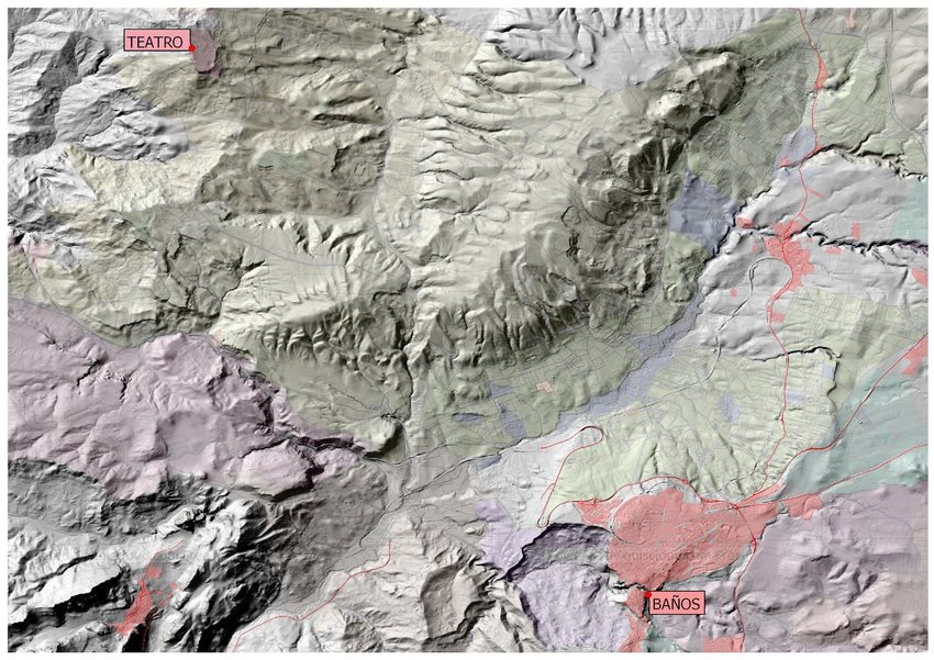
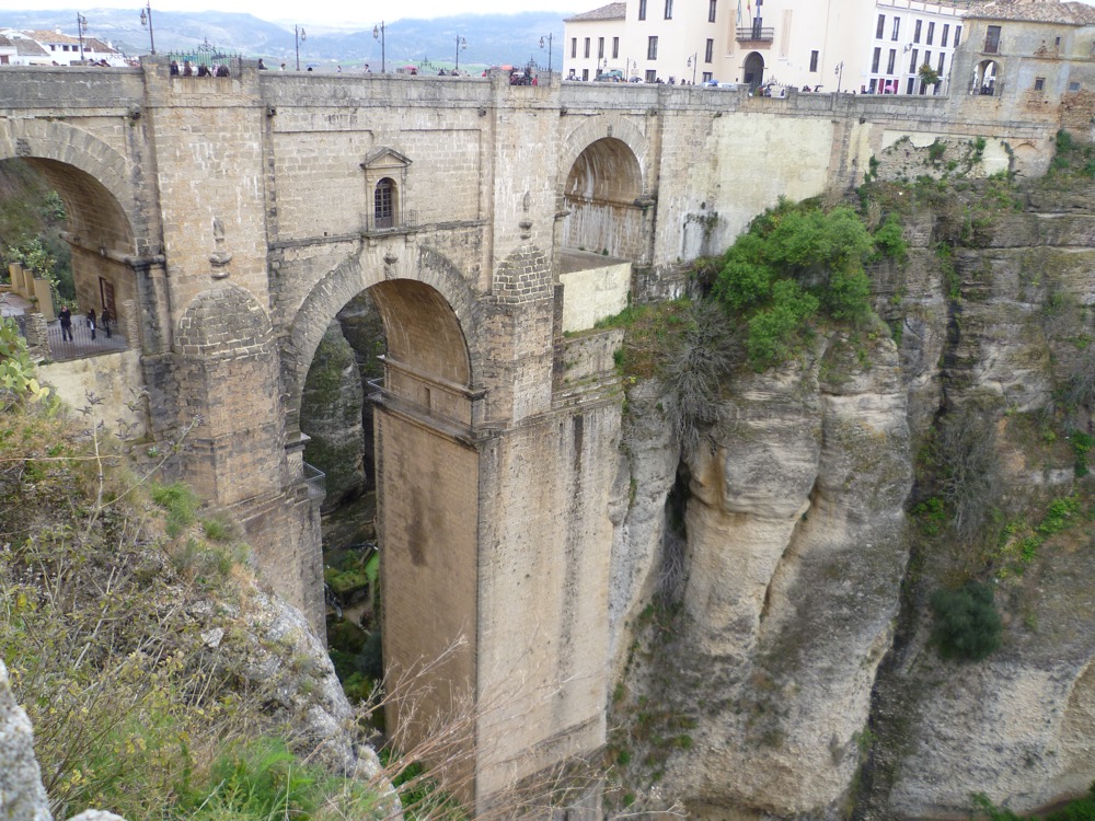
The result is what is today called the 'natural monument' of the Tajo de Ronda, a gorge (or chasm) evacuated by the erosive action of the Guadalevín River, a tributary of the Guadiaro River (the Guadalevín is marked out in blue).
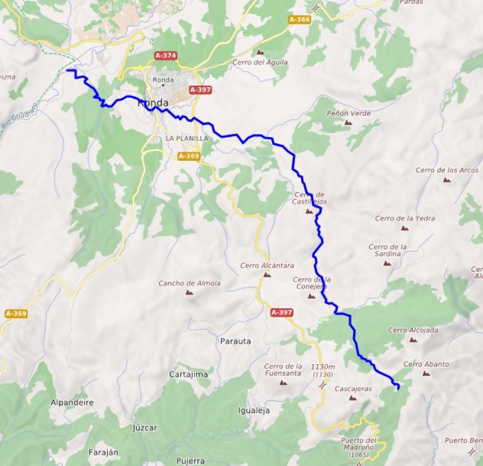
Tajo de Ronda
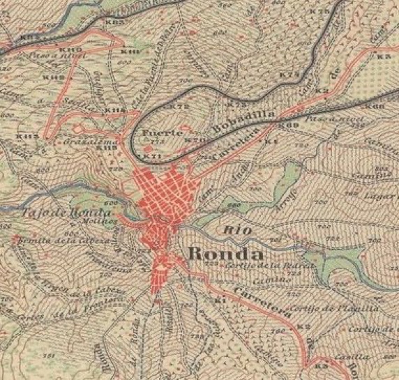
Today Ronda is located at the southern limit of the Depression of Ronda, a 300 square km area of between 500 and 800 m above sea level (Ronda is at 739 m).
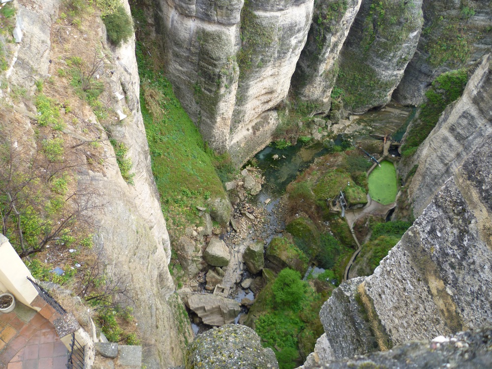
The Tajo de Ronda, passing through Ronda, is a 'chasm' (about 500 m long, and at times 100 m deep and 50 m wide), that then opens out into the so-called 'La Caldera'.
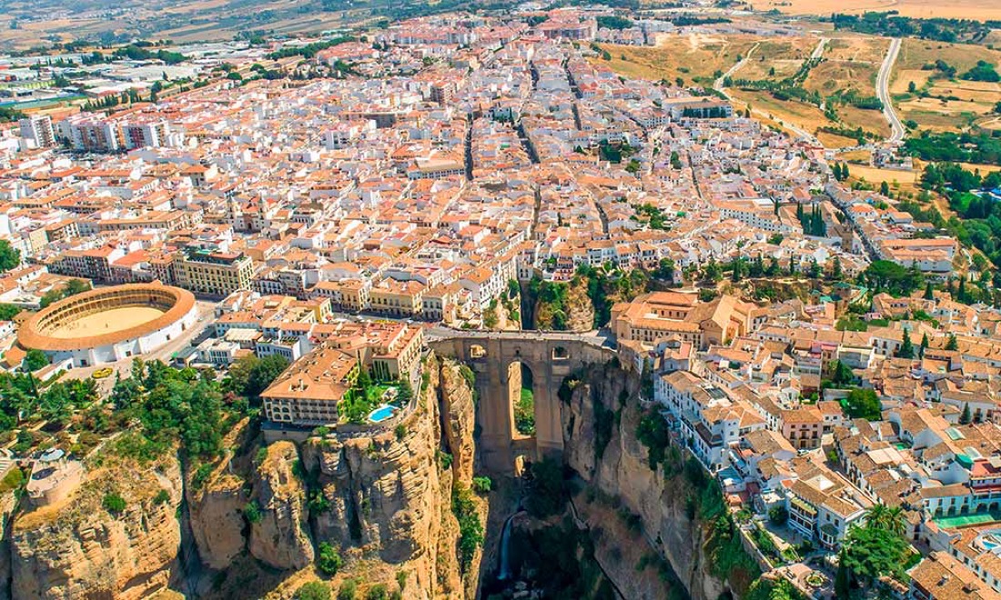
On either side of the Tajo stands the city of Ronda, on one side the small Old Town, and on the other the larger New Town.
History of Ronda
Neolithic remains have been found in the region, and the Paleolithic cave paintings of the Cueva de la Pileta could be at least 20,000 old. There are some indications that the upper parts of the edges of the Ronda plateau were occupied but very few remains have been found (e.g. clay pellets, remains of coals, pointers to the polishing of stone tools, etc.). The Megalithic necropolis of la Planilla made up of several collective tombs and dolmens suggest a semi-stable settlement starting in the 3rd millennium BC. I've read that a Bronze Age smelting furnace has been found in Ronda itself suggesting that ores might have been extracted nearby.
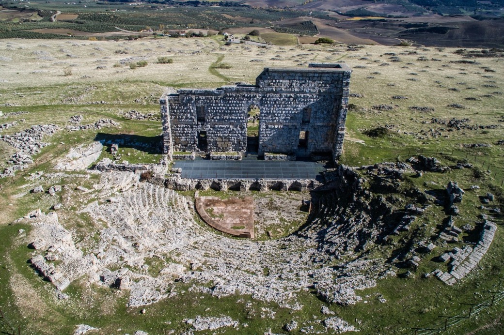
Some texts point to the Phoenicians settling in a nearby village called Acinipo, possibly in the 8th century BC. The site itself might have existed since Neolithic times, even if Acinipo is usually mentioned as an important Roman city of the 1st century AD.
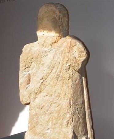
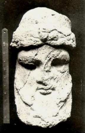
In Ronda there is a Nasrid house named "Casa del Gigante" because of a famous 'giant' stone carving. It's now been determined that the sculpture is a Hittite god from the Phoenician period, ca. 8th century BC.
However the origins of Ronda (originally called Arunda) have usually been associated with the Celts, ca, 6th century BC (a period often called época Ibérica). We know that in the region these peoples built circular and oval huts, terraced the slopes, created pottery, and worked bronze and iron. Commercial exchanges between the different communities meant that the Arunda site gradual emergence as an example of early Iberian urbanism (5th to 2nd centuries BC), including the introduction of the potter's wheel, iron metallurgy, square floor plans with multiple rooms, stone masonry walls, creation of regular flat surfaces and paved pathways, and the introduction of regular street plans, etc. Arunda has been identified as a seat of local aristocratic power, and a focus for the collective production of consumer goods.
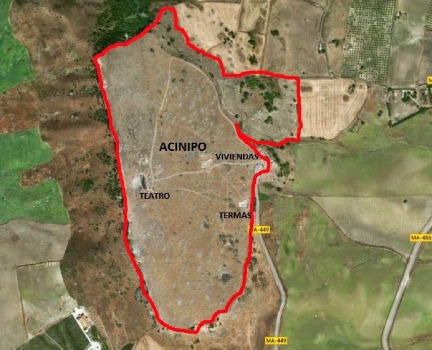
Above we can see the location and extent of the Roman Acinipo (about 15 km from Arunda/Ronda), and below we have the ruins of the Roman theatre large enough to seat 2,000 people (dated to the 1st century AD). Many texts suggest that the city was created for retired soldiers from the Roman legions, although other texts suggest that the site was occupied already during the Spanish Bronze Age. In fact excavations have shown that the site was already occupied around 5,000 years ago, and was also occupied by the Phoenicians. Acinipo was also known as Ronda la Vieja, and this has consistently sown confusion with ancient historians. It is said that the Muslims reused the area, exploiting the theatre as a watchtower. The theatre was also fortified during the wars between Christians and Muslims. This site is almost never visited, even by those living in Ronda.
Some texts suggest that the name changed to Runda when the site was conquered by the Carthaginians, however, this is not mentioned in the texts of the Museo de Ronda. The Roman occupation of both Acinipo and Arunda occurred as a consequence of the Second Punic War (218-201 BC), although initially the impact on Arunda was limited to the consolidation of residential areas on the upper terraces, and the conversion of the existing residential areas to artisan activities (e.g. ceramics and copper smelting). Romanisation appears to have developed more quickly in Acinipo than in Arunda. However this is not to say that Arunda lacked importance or investment.
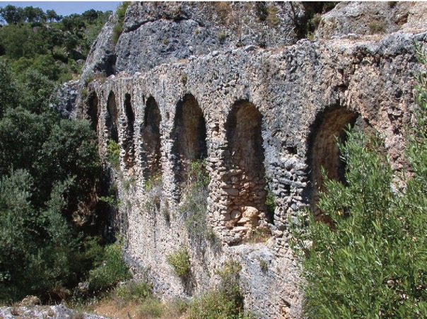
For example, the Romans built an 5 kilometres long aqueduct from the Fuente de la Arena to the outskirts of Arunda. From there they built the el Predicatorio tower-siphon to create sufficient pressure in the town.
It is interesting that the Muslims record the existence of the aqueduct, but it is not mentioned in Christian texts (possible because it was no longer used). It was only 'rediscovered' in the 18th and 19th centuries. The clay used in the building of the aqueduct was clearly a Roman mix, but there was evidence of modern repairs, suggesting that it had in fact remained in use. We now know that the aqueduct was 5 km long, and ran up and down 82 metres. In the city it went into a tank to gain pressure, and through a siphon system crossed the gorge, where the water pressure would again be established before being distributed. The cross section was about 30 cm by 30 cm, and the base was inverted clay tiles with limestone end faces. In some parts this canal was supported by masonry walls. The pillars seen above are Roman, but the upper arches maybe more modern.
In the period 1st to 3rd century AD Arunda continued to develop, but it appears to have experienced a certain redistribution of wealth in favour of Acinipo (possibly seen in the scale of some constructions and the associated infrastructure). By the time of Julius Caesar (100-44 BC), Arunda had become a Roman city. From the 3rd century AD many cities started to lose their influence as municipal powers, and what was public and civic started to become more rural and feudal. Gradually Arunda returned to being a rural settlement, whilst preserving certain symbols of early Christianity (which will serve in a subsequent urban resurgence in medieval times).
In 45 BC there was the Battle of Munda, the final battle of Caesar's civil war, which was held in some place near Ronda. The exact location of the battle is a matter of debate. Some have suggested that Munda could have been Ronda, but most experts think that it was near La Lantejuela, about 100 km north of Ronda. Some experts think that it was Ronda that was completely destroyed, and that a small Visigoth settlement nearby, named Onda or Unda, later emerged based upon cattle and wool. The idea is that when the Muslims arrived they built over the old Roman remains of Arunda, calling the place Izna Rand Onda.
Whilst Acinipo was abandoned (one text mentioned that it 'fell' in 429 AD), Arunda simply continued to slowly fade until well into the 10th century AD, when it 're-emerged' as a caliphate (a kind of polity based on Islam). This gave a new impulse to the town, as evidenced by the building of new walls that quickly overflowed the old Arunda. This new urban reality began to be called "Madinat Runda".
Some texts mention Arunda being taken over by post-Roman kingdoms that migrated into the region, and in particular King Rechila of the Kingdom of the Suebi (ca. 441-446 AD). Later the whole of Hispania would fall into the hands of the Visigoths (5th to 8th centuries AD). Arunda would become part of Orospeda, a Visigoth province. Tradition has it that the local population were happy to change Roman taxes and tributes for barbarian poverty and freedom. The Byzantines conquered an area in the south which they called Spania (ca. 554-624 AD), so I guess Arunda would have been implicated in the running conflicts between them and the Visigoths.
This is not the place to expand on the role of the invasion of the barbarians, but there is an argument for noting that they get a lot of unjustified bad-press for being stuck between the brilliance of Roman and Hispano-Muslim Andalucía. And most of the time it's just because they didn't build big monuments that we can still go and see today. If you are interested in delving into more detail about the Visigoth Kingdom of Toledo (586-711 AD) which some experts claim laid the foundations for a modern society, check out this publication.
In 711-718 the Visigoth Kingdom of Hispania was conquered by the Umayyad Caliphate (661-750 AD), establishing the wilayah of Al-Andalus. Arunda fell in 713 without a battle, and it is assumed that the life of most inhabitants remained much the same as before, i.e. they continued to be ruled by their own Visigoth law code (forum iudicum). Over time local nobles embraced Islam, whilst the majority remained Christian and used the Mozarabic language through to the 11th century. Al-Andalus started to fragment with the appearance of the Almoravids (1040-1147), the Almohads (1121-1269) and the last Muslim emirate, Granada (defeated in 1492).
Already in 713 Arunda was renamed Izna Rand Onda (the city of the castle), and nominated as capital of a province called Takurunna (pointing to a Berberisation of the region). With the disintegration of the Caliphate of Córdoba (929-1031), the city and region became a taifa, a kind of independent kingdom, ruled by Abu Nur Hilal ben Abi Qurra ben Dunas al-ifrani (ca. 1015-1059). Often called the first king of Ronda, he was of a Berber family who had originally fled to Al-Andalus in 994. Interestingly, he was defined at the time as "daring, greedy and a powerful leader because of the bravery of his men, the ruggedness of the area and the impregnability of its fortresses". He was succeeded by his son, who was defined as "drunk and constantly indulging in pleasure". The Taifa of Ronda only lasted from 1039 to 1065, so when, in 1066, the city was taken over by the Taifa of Seville (1023-1091), the inhabitants simply went on with their lives.
One story line is that Ronda initially resisted and obtained a dignified surrender, retaining homes, religions and cults, becoming more like an ally than defeated enemy. Some lands were distributed to Arab families to the detriment of the Berbers, resulting in a constant sense of discrimination, and the occasional uprising. The Berbers continued to settle in the region, and it was not surprising that in the 11th century a Taifa kingdom was created with Ronda as its capital. When it was annexed to the Kingdom of Seville it is said that Ronda was known as "el más florido florón de mi corona" (the most flowery flower of my crown).
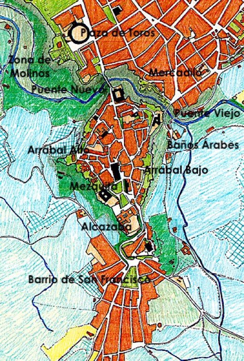
The idea is that Muslims would have built their main mosque near the old Roman castle which they would have developed as their alcázar, or central fortress-palace. By the Nasrid period (1230-1492) there were two suburbs, Alto (later Espíritu Santo) and Bajo (Las Curtidurías or tanneries). Both suburbs were outside the medina located on the hill. The Mercadillo was an open area with access through two bridge, Las Curtidurías (now often called the Roman bridge) and a newer bridge (now called Puente Viejo). The defence of city consisted of the cliff and a wall with two gates (Puerta del Viento and Puerta de los Molinos, later called Arco del Cristo). Another wall included the Almocábar Gate, near the Muslim cemetery located outside the walls. You could get to the Alto suburb along Calle las Imágenes and through a gate with the same name. Las Curtidurías bridge had its own wall and gate, and provide access to the medina (the old city). There were also additional gates called the Puerta de la Cijara and Puerta de las Mancebías. There were 21 mosques in the city, and the souk and shops were located near the main mosque. Shops were more like small family workshops, and there were numerous ovens. The Bajo (or Viejo or Las Curtidurías) was set between the wall, and the exterior was said to be dominated by narrow urban terraces following the natural slope of the land. The neighbourhood was destined for artisans and small industries, and was the location of the main baths (water was drawn from the river). Some houses had central patios, but most were simpler, smaller rectangular buildings. These suburbs were only fortified in the 13th to 15th centuries when Ronda became a stronghold in the flight between the kingdoms of Granada and Castile. At the same time walls were built to defend access to the mills. Also countless cisterns and pools were built to store water in the city, and a staircase in the rock was cut so that water could be carried up from the Mina spring to the medina during a siege.
There is an interesting description of Runda dating from 1087-88, saying that it is "a fertile, ancient, agricultural, livestock town endowed with many advantages. The mahaleb cherry tree grows in its mountains, the most precious of all aromatic species". In fact the Prunus mahaleb is cultivated for a spice obtained from the seeds inside the cherry stones.
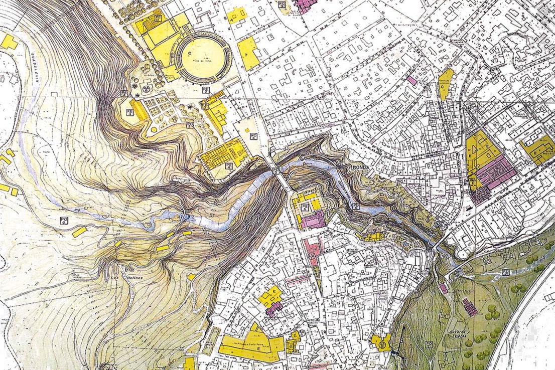
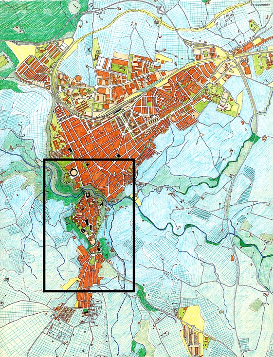
Below I have tried to capture something of the geography of the time, and for a comparison I have compared it with Ronda in 1972. We can see that we will really be focussing on only a small part of the modern town of Ronda.
Experts have highlighted the fact that judging by the abundance of town names still in place today the region received a significant influx of Berber tribes. It's suggested that the relatively harsh climate suited the Berbers who in any case preferred to organise themselves into small independent tribal entities.
In the region the different strongholds started to fall into Castilian hands, from 1407 with Zahara to Coín in 1485, so it was just a matter of time before Ronda fell. The idea was to take Ronda in the summer, so the winter was spent studying the fortress city. The initial idea was to take Málaga, and Ronda would fall. But Málaga resisted, so they turned to raid Loja. Forces were taken from Ronda, making it vulnerable to attack. In 1485 the Christians surrounded the city, took the water source, and a few weeks later Ronda was captured. Muslims lost their houses and lands and the spoils were rapidly re-distributed. Too rapidly, because in 1491 the entire redistribution process was repeated in a great "Repartimiento". Many of the Muslim houses were small but included a number of dependencies, and they were often redistributed to groups of two or three new owners (sometimes up to six new owners). Fighting broke out in 1501 when the promises of tolerance to the Moors were not respected, and Ronda again became the site of a battle. Victory came with some considerable damage to walls and houses. The city was divided into six areas, two still exist (Espíritu Santo and Santa María). Some walls were rebuilt with new entrance gateways, the minaret was converted into a bell tower, and a hospital was built. Little by little the idea was to change Ronda into a Castilian town.
On 22 May, 1485 Ronda finally fell to Fernando el Católico (1452-1516) after a prolonged siege. Many of the monuments and landmarks in the town were 'remodelled', with the old Arab centre being renamed "La Ciudad" (the city). Gradually the re-building work extended into the new neighbourhoods (barrios) of Mercadillo and San Francisco.
In 1492 the Spanish decreed that all Muslims must either vacate the peninsula without their belongs, or convert to Catholicism. Those who converted became known as Moriscos, however many overtly converted whilst secretly continuing to practice their religion. It would appear that they were obliged to wear a blue crescent on their caps and turbans. Travelling without a permit meant a death sentence, so it's not surprising that many Muslims took refuge in the mountains, including around Ronda. In 1566 Philip II decreed that the Arabic language was illegal, and he required that doors to homes remain open on Fridays to verify that no prayers were held. This led to numerous rebellions, including one in Ronda (which had already started with the rebellion of 1499-1501). One story is mentioned in Wikipedia, but I've found very little to substantiate it. The story goes that there was a bloody battle, in which as the Moriscos retreated the 'undisciplined' Spanish seeing victory looted the battlefield and surrounds. The Moriscos launched a surprise counterattack, and the Spanish leader, Don Alfonso de Aguilar, was hunted down and killed. Then all the Spanish soldiers were hunted down and killed. Stories differ, and in one story, the king ordered the massacre of all Moriscos in Ronda (the few who survived were sold into slavery). Another story is that the king ordered that the rebels choose between exile or baptism, but the trick was that you had to pay to go into exile, so most accepted baptism. After converting, they had to surrender their arms and forfeit all their property. These stories appears to be related to the systematic expulsion of all Moriscos from Spain decreed in 1609. Interestingly, official documents also record the death of Alfonso de Aguilar, but according to a slightly different storyline. This goes that he, as Lord of Córdoba, was appointed in 1501 to suppress the rebellion. Recklessly he fell into a trap, and was killed. His body was recovered by his servant, and his death immortalised in popular romances. In fact we know a lot about Alfonso de Aguilar as a very astute politician. Someone mentioned that he only appeared to support people but in reality he was "only a supporter of himself". It is in his fight to control the dominion of Córdoba that his supporters became known as "Aguilaristas".
In 1542 a new bridge was built making it easier to enter the city. And in 1572 the Real Maestranza de Caballería de Ronda was founded to school those handing weapons on horseback. However their true focus appears to have been on bulls and horse riding, and in 1785 they completed (and still own) the 'plaza de toros de Ronda' (bullring). At about the same time the old medina retained the name "La Ciudad" (the city), whereas the old Barrio del Espíritu Santo took the name Barrio Alto, and the area of San Miguel took the name Barrio Bajo. Different texts have the name changes the other ways around, and there appears to be a lot of confusion about the names of these different 'older' barrios. I've never seen a definitive text with the name changes and dates. The barrios of Mercadillo and San Francisco continued to expand as residential areas. One text suggested that the Mozárabe population was probably concentrated in the Barrio de Mercadillo, outside the city walls. Also after the Christian conquest the Barrio de San Francisco increased to become a full hamlet because it surrounded the road leading to Gaucín and Gibraltar. Only the Barrio del Espíritu Santo has retained something of characteristics of Islamic urbanism, i.e. narrow streets, simple entrances, central patios, white painted walls with few external windows, etc.
In 1492 Ronda was depopulated leaving only 401 inhabitants, and the town was put under the jurisdiction of Málaga. During the repopulation the original medina, and Alto (Espíritu Santo) and Bajo suburbs were retained, along with two new suburbs outside the walls, barrio de San Francisco and barrio Mercadillo. Both owe their existence to merchants who remained outside the wall so as to avoid paying taxes and fees. The old main square was adapted for a church built over the old mosque, local offices and a jail. And a cereal store (el pósito) and a grain store (alhóndiga) were placed just next door.
The nobility was always expected to be trained for war. Spain was full of military orders, confradías (brotherhoods), maestranzas and other cavalry troops. The Crown required that nobles ride and handle weapons, and tournaments were a key training technique, including confronting bulls. Once its obligations to the Crown were completed, Ronda continued to maintain a riding school, and including bullfighting. In fact it is said that the galleries were added to the La Iglesia Santa María la Mayor so that nobles could observe the tournaments and bullfights, and it is also said that the main streets through the barrio San Francisco were used by knights to train in the handling of weapons and for equestrian exercises.
Ronda society as it approached the 18th century was made up of the nobility, the clergy and the peasantry. Ronda was eminently agrarian, with the nobility and clergy monopolising the best lands and controlling much of the rights and tithes. The nobility monopolised the local government, thus managing the rents and the interpretation of "Ordenanzas". The peasantry were tenants, sharecroppers, mostly day labourers, and a few owners of small farms. The 18th century would see the arrival of a bourgeoisie made up of manufacturers, artisans, merchants, and the military.
The 18th century started with the taking of Gibraltar by the Anglo-Dutch fleet in 1704. Immediately the strategic significance of Ronda increased (today's town hall was once the barracks built in 1734). It was in the period 1751-1793 that the Puente Nuevo (New Bridge) was built, a construction that now symbolises Ronda. Both the bridge and the bullring were the work of José Martín de Aldehuela (1729-1802). The new bridge was key, it opened up new streets, new housing, new shops … in fact it gave birth to a new Ronda.
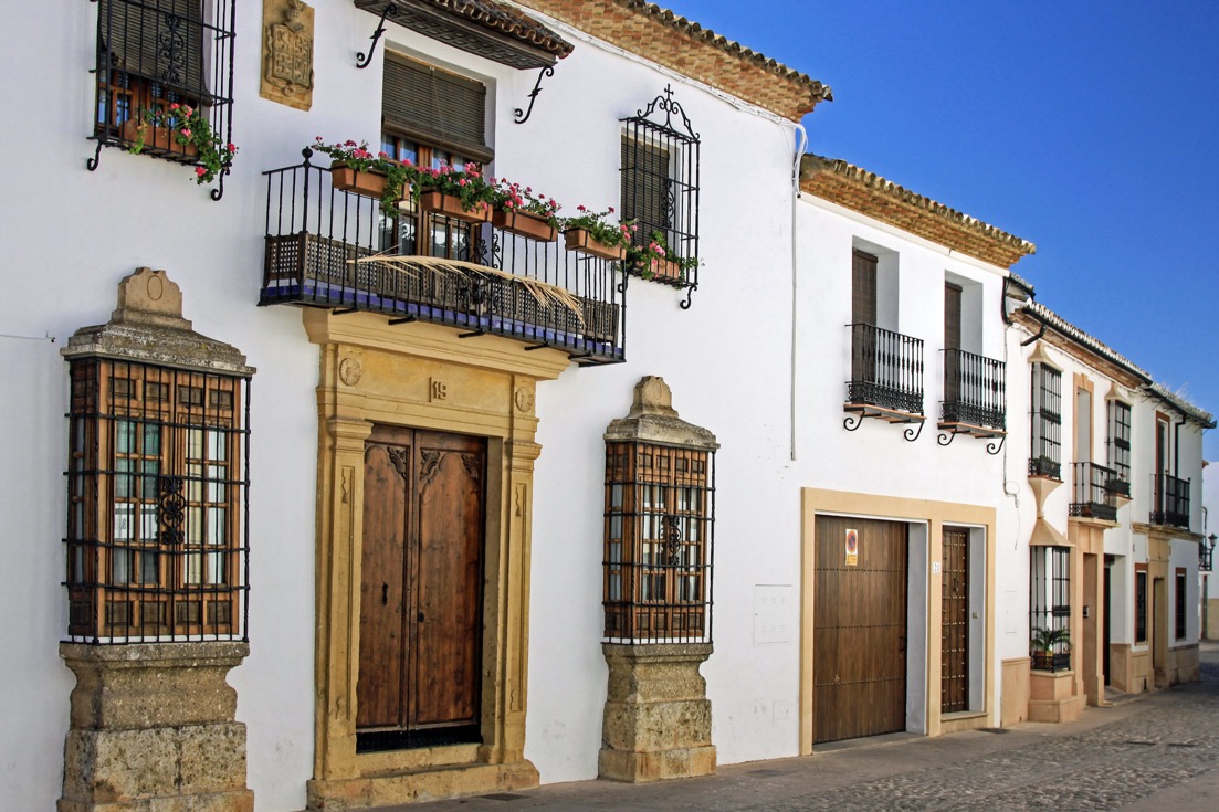
With the Castilian victory the richer families took over some of the old Muslim houses. They created small manor houses (casas solariegas) by opening up new doorways and by enriching the simple façades with coats of arms, etc. Some barred windows were opened up and converted into increasingly complex looking balconies. The result was a kind of mix of Gothic and Mudéjar, and some homes because true palaces (palacios). In the newer areas the houses took inspiration from the tradition to have narrow entrance corridors leading to interior patios, which became true focal points in the homes.
The Napoleonic invasion (1803-1815) and the subsequent Peninsular War (1807-1814) resulted in Ronda losing about ⅔ of its population (reduced to about 5,000 inhabitants). The French demolished Castillo del Laurel (the old alcazaba or citadel, so a kind of palatial fortification) and many of the local mills, crops and livestocks were decimated. The local population was driven into the hills as guerrillas fighting the invaders (resulting in the later emergence of banditry in the area).
Today we look at Ronda as a tourist destination, possibly with a useful background activity in agriculture. But in 1861 there were 19 flour mills and 21 mills for make olive oil. There were 15 factories for tanning, and making soap and starch, and for producing yarn as well as linen, wool, and cotton fabrics. There were also two potteries, two blast furnaces, and a gunpowder factory. The importance of the mills to the city had already been noted by early Christian chroniclers, and in fact after the Reconquista they all fell into the hands of the church, the monasteries, the Royal Hospital in the city, and five powerful private owners. The access to, and use of, water was heavily regulated, but in 1905 Ronda saw the first conversion of a mill to electricity generation. The real change occurred in 1917 when a large rockfall crushed several mills, killing 16 people. In 1926 it was decided that more electricity was needed and that the flow of water should be dammed and piped directly to the turbines. The electricity company bought the other mills and the surrounding land so as to monopolise access to the water.
One far less well known part of the history of Ronda is the creation in 1731 of the "Real Fábrica de Hojalata de San Miguel de Júzcar". The factory was located away from Ronda after Felipe V (1683-1746) granted a license to the Swiss Pedro Meurón y Compañía to build a tin factory. They had demonstrated the ability to "whiten white iron making tin foil, hitherto ignored in these Kingdoms". They were allowed to freely exploit the forests to obtain coal, to build houses and warehouses, and to sell the can, etc. It was said that Spain spent 28 million reales per year importing this product from Germany. It would appear to have been a disaster, despite bringing in 30 officers and workers from Germany. In the period through to 1787 the company almost collapsed, and in 1737 the army was sent to resolve a problem with access to water. The king even sent six camels to the factory for transporting the product. The process involved the melting of iron ore in a blast furnace, and then turning it into soft iron in a refining furnace. Then this would be transformed into fine 'black iron sheet' suitable for tin plating. If the process did not work perfectly, the iron would go for bars, slabs, plowshares, horseshoes, rings for barrels, etc.
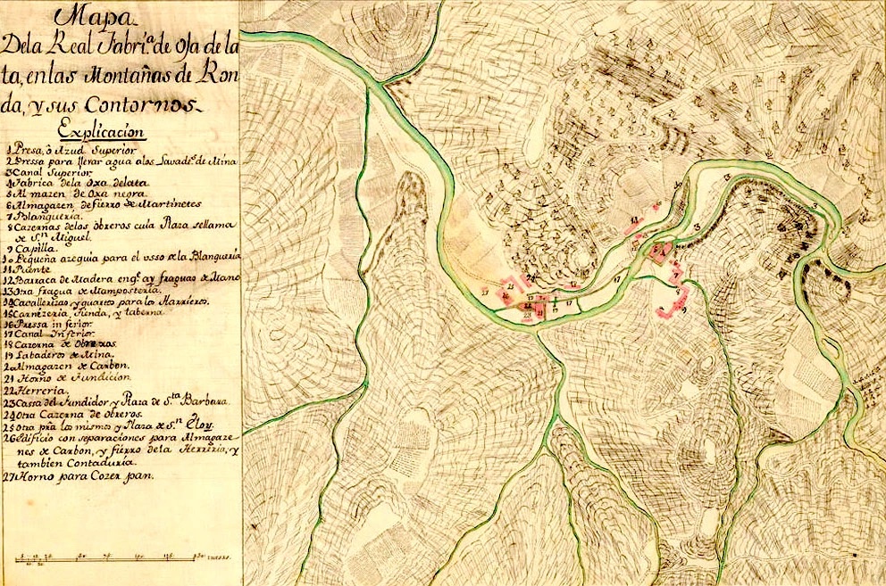
The whole effort failed in part because of poor water pressure in the summer, and in part because they did not sell the entire production (despite the camels, the transport costs were too high). Yet on paper it was perfect. Next to the Genal river, huge forests, iron mines, and not far from the port of Estepona. Experts all agreed that the factory site was as near perfect as possible, yet it failed.
With the arrival of the railroad at the end of the 19th century, a true bourgeoisie started to appear. They started to build their homes in the better areas of the Mercadillo. The above map dates from 1916, and black line is the very odd route the railway took in passing 'through' Ronda.
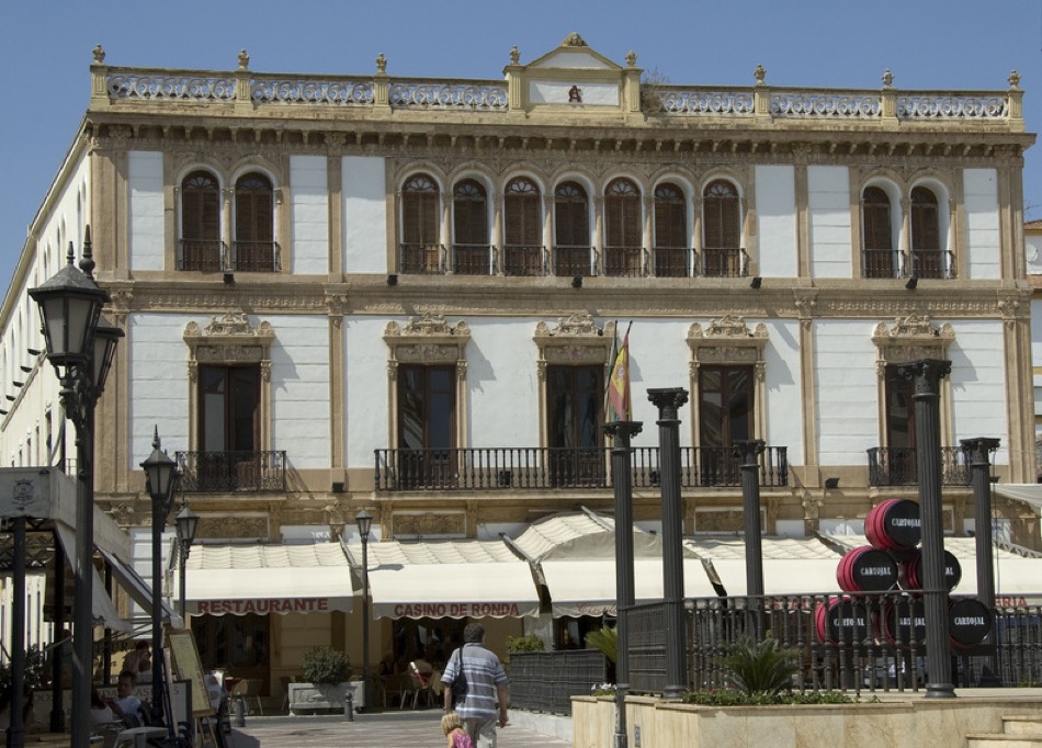
The best know architect of the period was probably Santiago Sanguinetti Gómez, who is said to have introduced so-called Secession or Viennese Modernism into the regional architecture (often called Mudéjar or Plateresque). He only spent 2 years in Ronda but he established a trend that continued for decades. The most obvious example is the Casino de Ronda (below), which is home to local cultural events and one of the town libraries.
On the rest of this webpage I have tried to point to some of the sites worth visiting, but this does not replace a good guide book, or even better a knowledgable guide.
Visits and Vistas
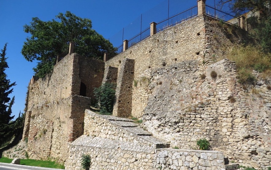
For defensive reasons the alcazaba Castillo del Laurel (above) and the mosque (later replaced by the Convento de Clarisas de Santa Isabel de los Ángeles) were built on the highest part of land. Initially Ronda was divided into the Alto or Nuevo suburb (later to be called Espîritu Santo), and the Bajo or Viejo (also called 'de las Curtidurías' meaning tanneries, or also known as San Miguel after a church built over an old mosque).
The alcazaba probably dated from the 11th century, but appears today more like a 14th century fortress. It was damaged several times, and has undergone substantial modification and rebuilding. It sat on a rocky spur, had a double set of walls with fortified towers, and with the Puerta de las Imágenes (now disappeared), it controlled the entrance to the city.
In one travelog it was suggested that the castle was built (or re-built) in 1331 AD and given (or had been given) the Moorish name Hisnorrendi, or the laureled castle. The suggestion is that this became over time El Hisna Randa, which after 1485 AD became Ronda.
The mercadillo (open-air market) was installed in an uninhabited area of the town, and accessed through two bridges. The Curtidurías, (later called 'Old' and today 'Roman'), and a newer bridge (which later became the 'Old Bridge' when the new third bridge was built in the 18th century). Initially the defence of the town consisted of the natural barrier of cliff faces, acting as a kind of moat sometimes up to 100 m deep in the steepest parts. So the town (medina) was more or less define by the cliff faces and defensive walls.
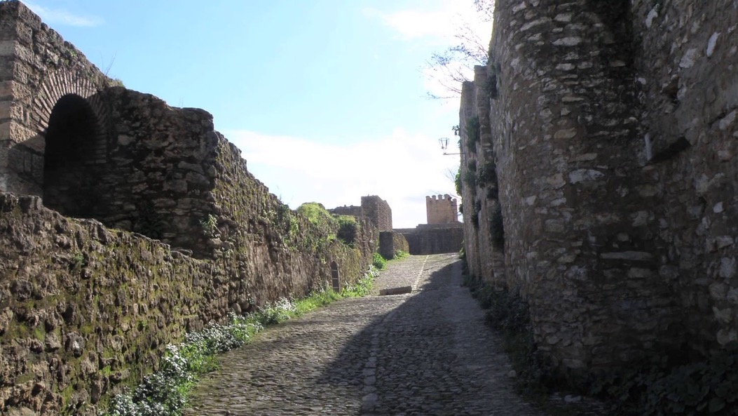
What became known as the Arrabal Viejo (old quarter) was the old Nasrid (1230-1492) neighbourhood very close to the Arab Baths. This area was also known as that of the mancerîas (bartenders), the tanneries (curtidurías) or that of San Miguel. It was located between two walls, next to the river. The tanneries, baths, and potteries all needed water, and located between the walls, they had access to the river. Over time it became home to the poor, and the neighbourhood of all the old trades (pre-industrial activities) in the town, with a profusion of small shops and artisan workshops. Outside the walls there were some small terraces following the slope of the land.
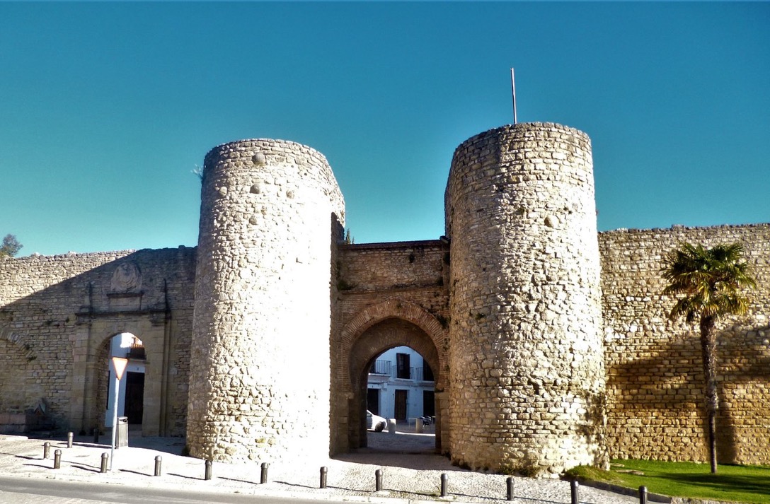
The Puerta de Almocábar, located in the southern part of the city, was built in the 13th century and later restructured in the 16th century (restored in 1961). The name comes from the "Al-maqabir" cemetery, because it was near the main necropolis outside the walls, according to Islamic custom. It was in the Plaza de San Francisco, opposite the gate, that the Castilian troops gathered in 22 May, 1485, bringing to an end Arab domination of the town and surrounding mountains.
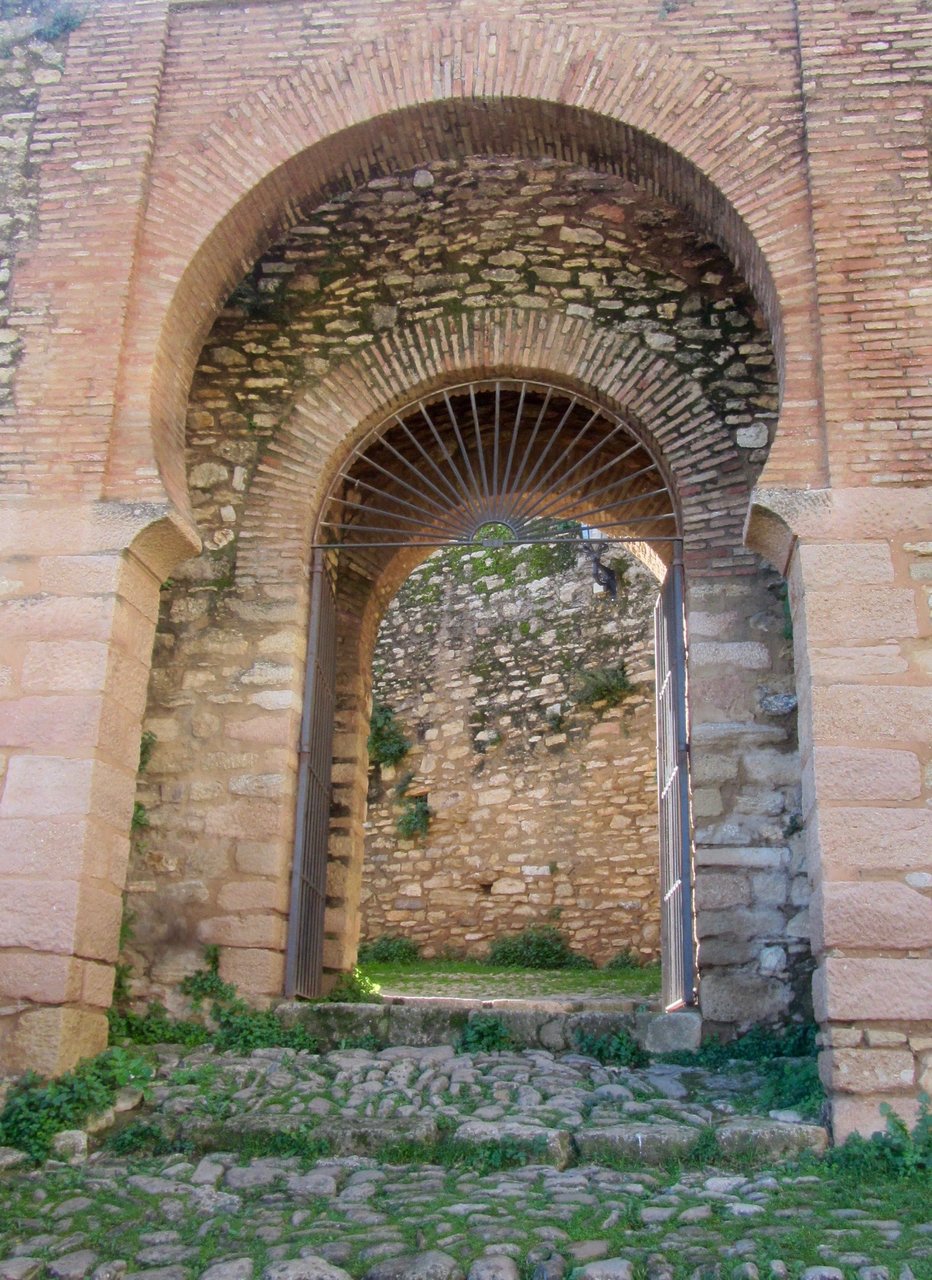
This puerta provided access to the Alto or old suburb (now called Espîritu Santo) of the Muslim medina. The Arabic entrance was located between two semicircular masonry towers. In the middle of the 16th century an additional semicircular archway was added with a large royal shield supported by an imperial eagle. The original gates had some kind of sliding-closing mechanism, and an additional external door was added in the 16th century. The additional gate with the imperial eagle was where city taxes were paid (this particular gate is often called the Puerta de Carlos V). The ensemble is the most monumental of the gateways into Ronda, and during the 18th century it received a number of different names, Puerta de Ximena, San Francisco, Alameda and Los Canos.
As far as I understand things, passing through this gate, you could then approach the only gate in the wall protecting the Muslim medina, a gate protected with a drawbridge and portcullis.
Going through the Puerta de Almocábar you can walk up past the ruins of the alcazaba and what remains of the Castillo del Laurel. Another 150 metres takes you to the Plaza Duquesa de Parcent, one of the most emblematic places in Ronda, and in many ways can be considered the town historic centre. If the weather is good, this is a lovely public space surrounded by monuments, and cafe terraces.
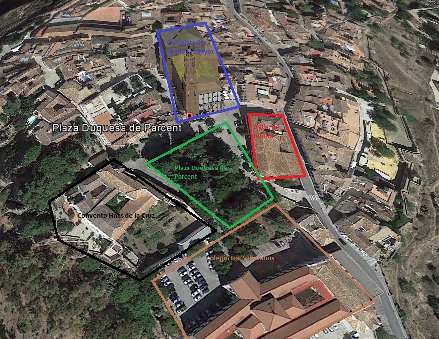
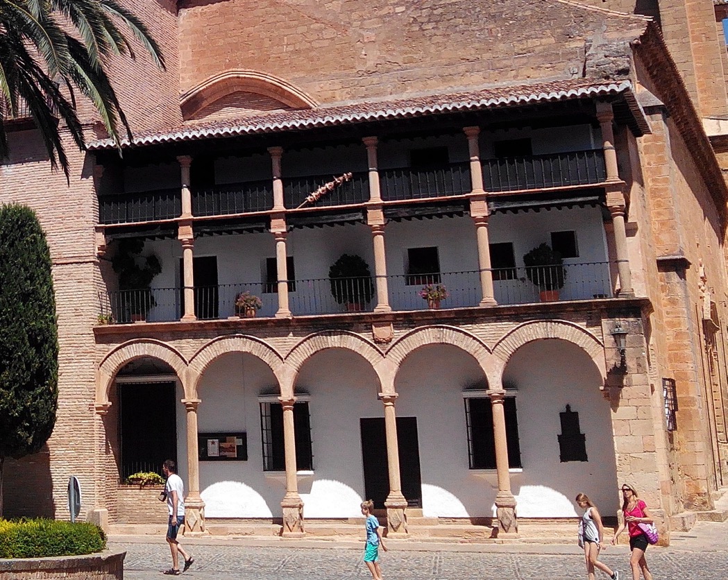
In the above map passing the Castillo del Laurel you have what used to be the Colegio Los Salesianos, and then you enter Plaza Duquesa de Parcent, (green) which is surrounded by the Ayuntamiento de Ronda (red), La Iglesia Santa María la Mayor (purple), and the Convento de la Hermanes de La Cruz (black).
Firstly the plaza itself is thought to date from Roman times, and was probably the site of a temple created in honour of Julius Caesar. In fine weather it's nice to try to identify some of the different trees in the gardens, e.g. a Schinus molle 'false pepper', a Cupressus, a Myrtus, and a Citrus aurantium (bitter orange).
The plaza is named after the second Duquesa de Parcent, who was in fact called Trinidad von Scholtz Hermensdorff. Born in Málaga in 1867, she married Manuel de Iturbe del Villar, who represented Mexico in Madrid. During her time in Madrid she founded in 1901 the Philharmonic Society of Madrid, which focussed on chamber music and perhaps more importantly wind chamber music which was not fully appreciated in Madrid at that time. She founded in 1912 the Revista de Arte Español (it closed 1969 but back copies are still available). In a visit to Ronda in 1911 she decided to buy Casa del Rey Moro. It is said that some people were convinced that it was an authentic Muslim palace, whereas it was actually built in the 18th century. She then bought the adjoining houses and commissioned a garden. After the death of her first husband, she married in 1914 the Duke of Parcent. She died in Vienna in 1937.
There is a nice story associated with her that will find an echo throughout this webpage. There is mention of a water source called the Mina, and the need to bring the water up to the medina. The source is not the river itself, but a real separate water source at the level of the river. One story goes that in the 14th century using a crack and a small cave in the cliff wall, a wheel was built and driven by Christian captives, bringing water up to the old city. The conclusion was that a traitor revealed this secret, resulting in the capture of the city some week later. Another story suggests that the Mina source was the original 12th century Arab baths. In any case once abandoned, it became a legend. Until the Duquesa reinstalled the decent to the river, established a small jetty and walkway along the river, and reached the small cave where she installed an image of the Virgin.
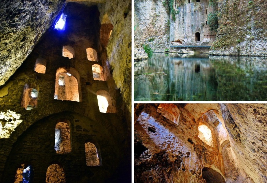
It certainly does not help that 'Mina' translates in English as mine, but early Christian chroniclers clearly mention its existence as one of the key points in the surrender of the city. It is a source or fountain of water that is not related to the river itself, but appears almost at the level of the river. At the time its existence was a secret as was the 130 steps decending down to the source. It would appear that it was discovered, the wall broken through, and the Christians stopped the water being carried up to the city during the siege. There is even mention of the fact that the shackles and chains used on the Christian slaves who raised the water to the city, were later hung from walls of a church by order of los Reyes Católicos. What we learn is that the slaves were chained in dungeons set off from the stairs, but they raised the water by carrying full waterskins on their backs. It appears that the passageway was closed up, and became a simple legend. However a lower part was rediscovered 1616, and the upper part of the stairs leading to the Casa del Ry Moro was rediscovered in 1709. The staircase appears to have been developed in sections, and linked together by masonry arches and vaults.
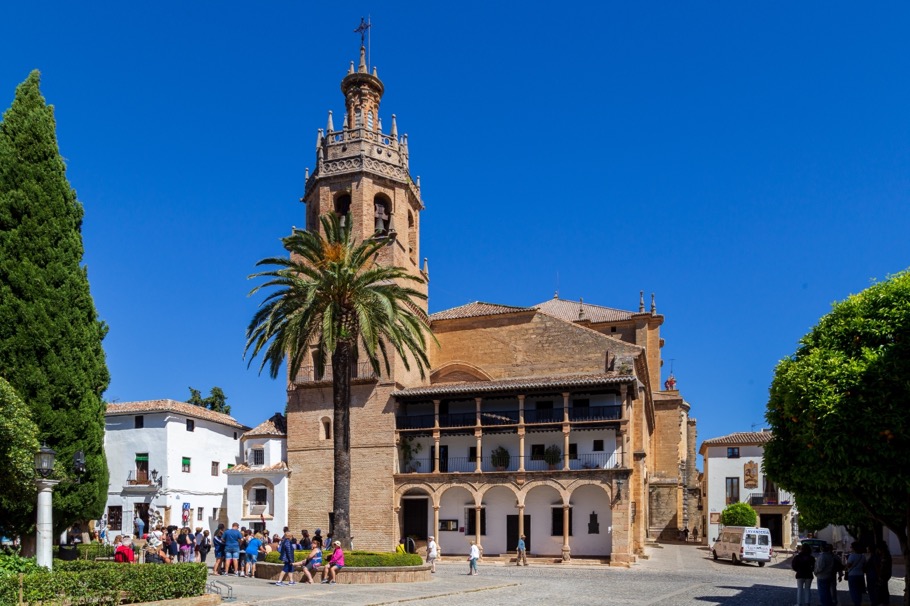
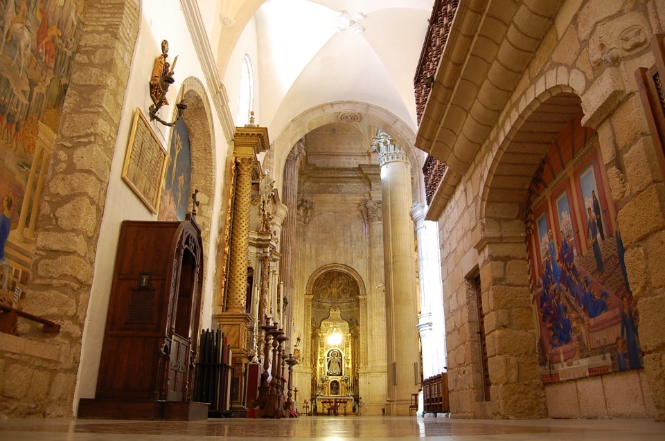
The star in the plaza is La Iglesia Santa María la Mayor, a church commissioned by los Reyes Católicos, and probably built over the ruins of the 13th century aljama mosque (which may well have been built over the ruins of a Roman temple). The entrance to the mosque would have faced Mecca, so it would have been at the back of the church as it stands today. In the interior a part of the mihrab is still preserved, but its obscured by a very ornamental retable behind the altar. It would appear that the work must have started quite quickly after 1486, but it took more than 200 years to complete. The general layout is Gothic with pointed arches, etc., but a part of the church had to be rebuilt after an earthquake in 1580. They were able to adopt the more majestic Mannerist style, but they only completed than part in 1720. Highlighting the different periods and style, there are Gothic pillars attached to taller, fluted columns with Corinthian capitals.
Initially the church was built as a cathedral, but in 1851 it was accorded the status of Iglesia Mayor, which usually means a minor basilica (there are more than 1,000 of them in Europe and its not mentioned on the list on Wikipedia).
The original façade was damaged when the old minaret of the mosque was struct by lightning in 1523, and a second Gothic style façade was rebuilt. At the beginning of the 17th century a triple gallery was added to the façade. The upper floors are supported on Tuscan columns, whilst the two upper floors use stone columns and lintels. The galleries were built so that local aristocracy and the authorities could enjoy the cavalry games and bullfights that took place in the square.
The tower is of the Mudejar style, based upon the design of a minaret, but its topped with a Renaissance bell tower. There is a small masonry and brick chapel attached to the tower, which is believed to have belonged to the old mosque.
I've read that in the bell tower, the quintuple carillon rings every hour, and is famous for the clunk on the last note rung by a broken fifth bell.
There is also an unusually long building that now belongs to the local council (ayuntamiento). Stories different concerning dates, but all accord that the building was built in 1734 as the headquarters of the old Provincial Militia (some reports say 1651 and restored in 1734). It is said that the basic building was probably an alhóndiga of Muslim origin (there are grain stores still at the back of the building). After 1818 it was converted into a cavalry barracks.
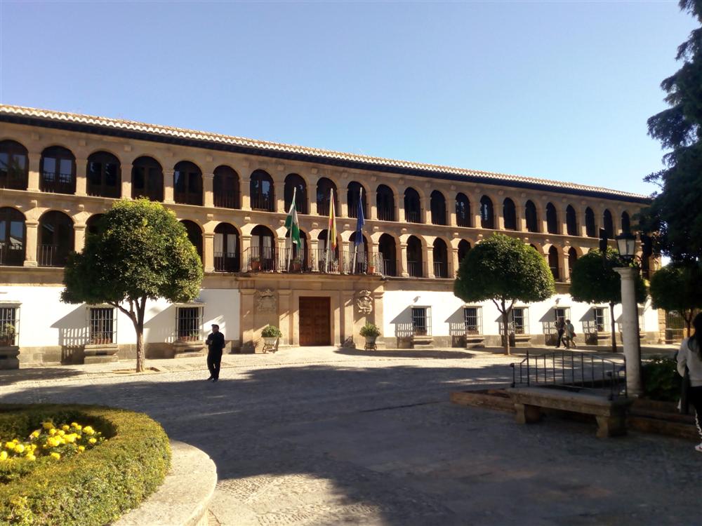
I've read that today it houses offices, a police station, and in the basement a cafeteria that is open to the public.
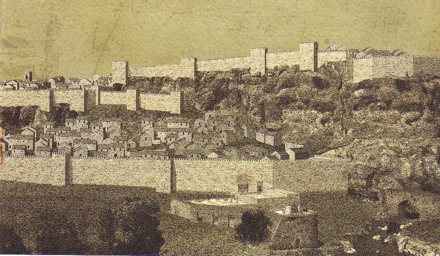
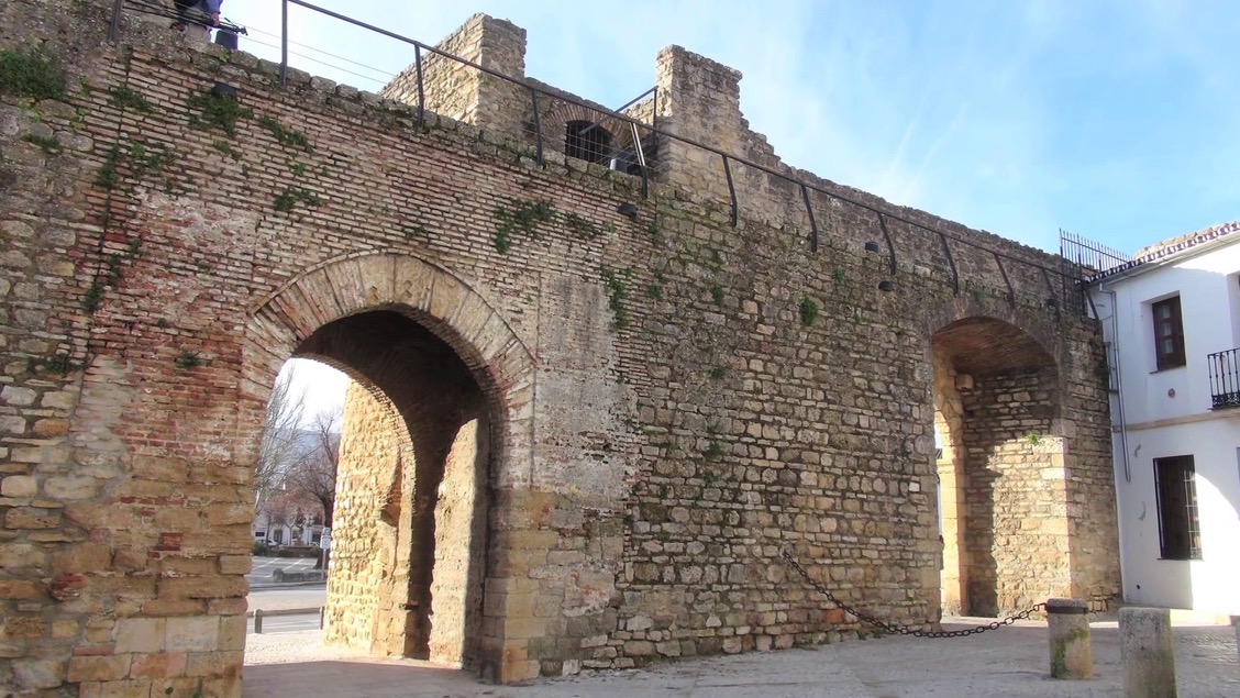
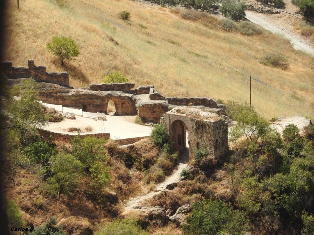
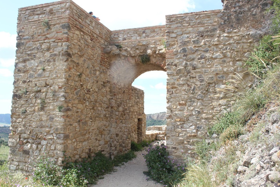
The old town was protected by a whole chain of walls and gates. Above we have a reconstruction of what those defensive walls might have looked like, and below we can see the remains of the eastern Murallas de la Cijara with its Puente de la Cijara. I've read that this gate might have been called Puerta de la Ecijara or Puerta de la Zixaja.

The Puente de la Cijara consisting of three consecutive arches, a central ogival arch set against two exterior horseshoe arches with alfiz. This gate provided access to housing built between the double defensive walls, where the Arab Baths were located.
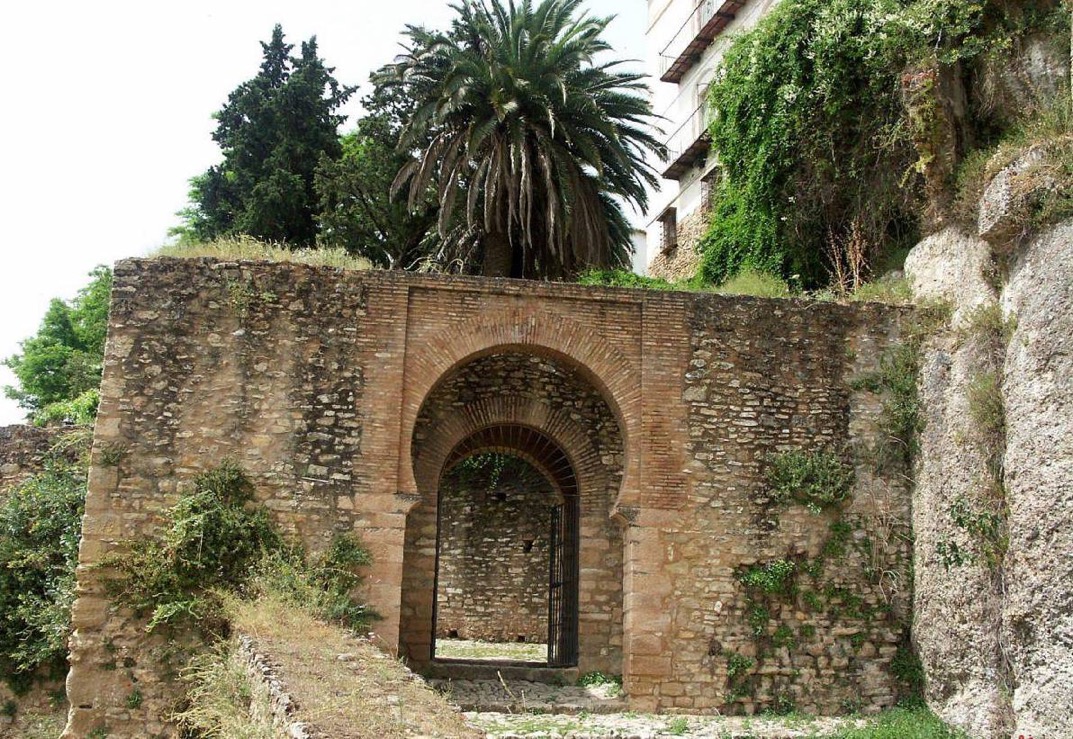
In addition the defensive walls of the old town there were also the Murallas de la Albacara, which defended the productive area of the town's mills and livestock. There were also other access gates, the Arco del Cristo (also called the Puerto de los Molinos) and the Puerta del Viento.
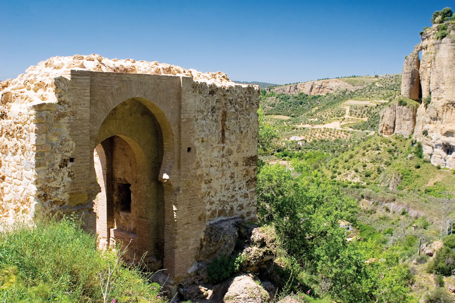
The Arco del Cristo (or Puerto de los Molinos) is far from being a simple construction, being clearly designed as a defensive structure set between two rocky outcrops. As with many of the gates this one consisted of three different arches, with an intra-arch space with two niches of religious significance. It is these niches that later gave the gate the name Arco or Puerta del Cristo. It is said that farmers and workers in the mills would pass through this gate daily, and one of the niches was a small chapel with a crucified Christ lit daily by an oil lamp.
The Puerta del Viento, is a simpler weathered brick arch that provided access to what was called el Valle de los Potros (Valley of the Colts).
A traveller from Granada, coming from the north, would have entered through the "Puerta de la Puente" (now demolished) located near the Arab Baths. In the earliest time, the Arab Baths and the poorer suburbs were outside the earliest town wall (a second defensive wall would later be built). It was between these walls that you found the tanners, potters, cobblers, etc. The Arrabal Viejo represented about 20% of the Nasrid city, which represented about 16 hectares (160,000 square metres). It's interesting that the Christian artillery attacked the walls of the Arrabal Viejo, and once they had conquered Ronda, they urgently repaired the damage because they were still at war with Granada. Part of the problem had been that people had started to move to a new neighbourhood called the Mercadillo, and the old walls were poorly maintained.
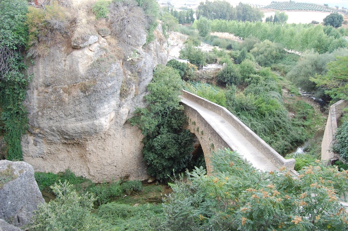
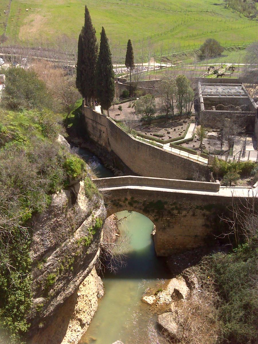
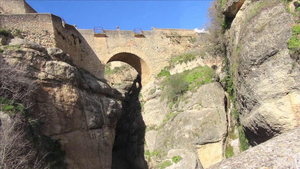
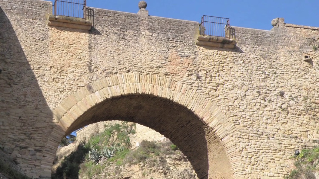
We now turn to the three bridges in Ronda, and the constant confusion concerning their names. Above we can see the Puente de las Curtidurías, a bridge of Arab origin and dating to the 13th century (but the design could be 11th century). It must have been one of the first connections between the two sides of the gorge (Tajo), because it is clearly built in the most accessible point. It would have allowed the town to expand to the other side, to what would become known as Barrio de San Francisco. It is also said that it gave cattle access to the waters of the Guadalevín. When a new bridge was built in 1616, this one became the 'old bridge', and when they build a new, new bridge, the old new bridge became the old bridge (Puente Viejo), and this bridge became the Puente Arab, but everyone knows it as the Puente Romano. It is made of stone slabs, and has a slightly pointed arch with a span of about 12 m. It would probably have had a walled gate and a barbican tower. It got its first name Puente de las Curtidurías because the tanners installed themselves next to the bridge so they could easily access the waters.
There is a story that Christian captives were often condemned to bring up waterskins from the river bed for the animals in the pastures. These captives were treated in great contempt, and there was a saying "En Ronda mueras acarreando zaques" (In Ronda you will die carrying 'zaques' — waterskins). Naturally, there are usual stories involving slaves actually chained to the stairs and passing water up to the medina.
The Puente Viejo (old bridge) that we see today was rebuilt after the Reconquista, and dates from 1616. Just as the Puente Romano connected to the new San Francisco neighbourhood, so this bridge opened up the fledgling Mercadillo neighbourhood. Experts don't agree on the origins of this bridge, some thinks it's Arab, and some think that they built it over an older Roman bridge. In any case it was destroyed during the Reconquista. A new bridge was ordered in 1486, and apparently rebuilt by local criminals. However, it was washed away in floods in 1616, and so it had to be rebuilt again.
The 'Alameda del Tajo' (an 'alameda' is a public promenade shaded with trees), was originally called the "Alameda de San Carlos". Completed in 1806, it is located next to the bullring, and sitting on the Tajo cornice provides excellent views of the Serranía de Ronda. It was paid for from the fines of those caught in "scandalous behaviour".
A Victorian traveller entered old Ronda through a succession of gates, before seeing a "tolerably straight street terminating in a new bridge lined with handsome shops". However from the street there were "numerous alleys (for they deserve no better name) leading off right and left, winding and turning in all directions, and communicating with numberless little courts, crooked passages, and cues-de-sac, quite in the style of an eastern city". Our traveller confessed that the 'new town' was "by far the most agreeable place of residence". The streets "were wide, tolerably straight, containing fine open plazas, and enjoying a free circulation of air".
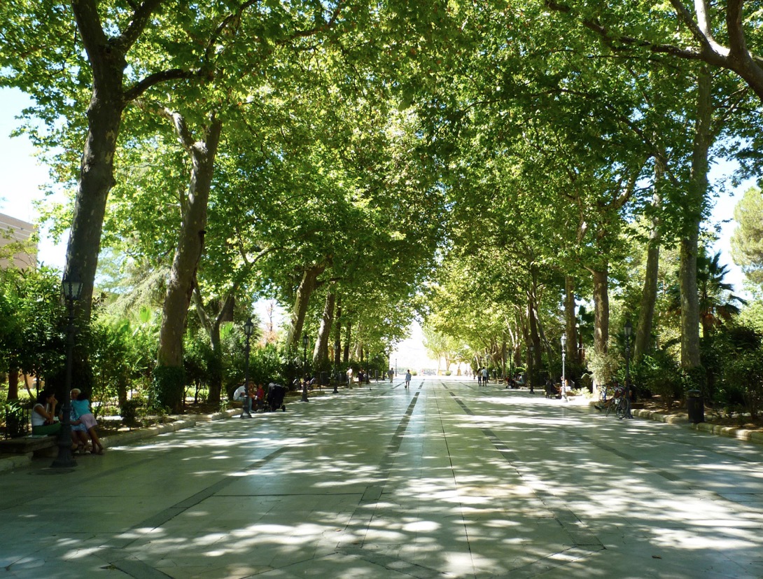
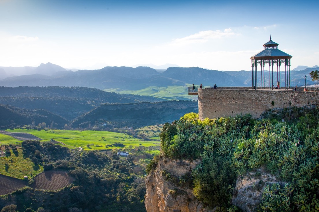
The 'Alameda del Tajo' is formed by five parallel avenues of trees and plants, all leading to an impressive balcony overlooking the valley below. There are some notable trees to look our for, namely the Himalayan cedar, the stone pine and the three-thorned acacia. There are public walkways along the cornice, but you can't today walk the entire length (which in annoying).
You often read that you should stroll through the tree-line park to the gazebo at the cliff edge, and appreciate the spectacular views over the valley below. This is not perfectly correct. The Alameda del Tajo is a public garden with wonderful views over the Depression of Ronda and not the Tajo de Ronda. But you can walk along the cliffside, behind the Plaza de Toros, to the Mirador de Ronda (often called la Seviliana) where you can find the famous gazebo. You can then continue to walk along the cliffside around the Parador Hotel, and to the Puente Nuevo where you can get a view of the gorge, Tajo de Ronda. Walking along the cliffside you can look back towards the Mirador and see the view that has often been immortalised as seen below.
I am going to do little more than just mention the following three monuments in Ronda, because I've allocated a separate webpage to them.
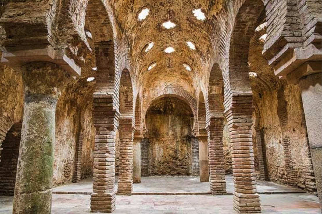
Near the Puente Romano we have Bańos Árabes, often called "de Galiana" or "de San Miguel".
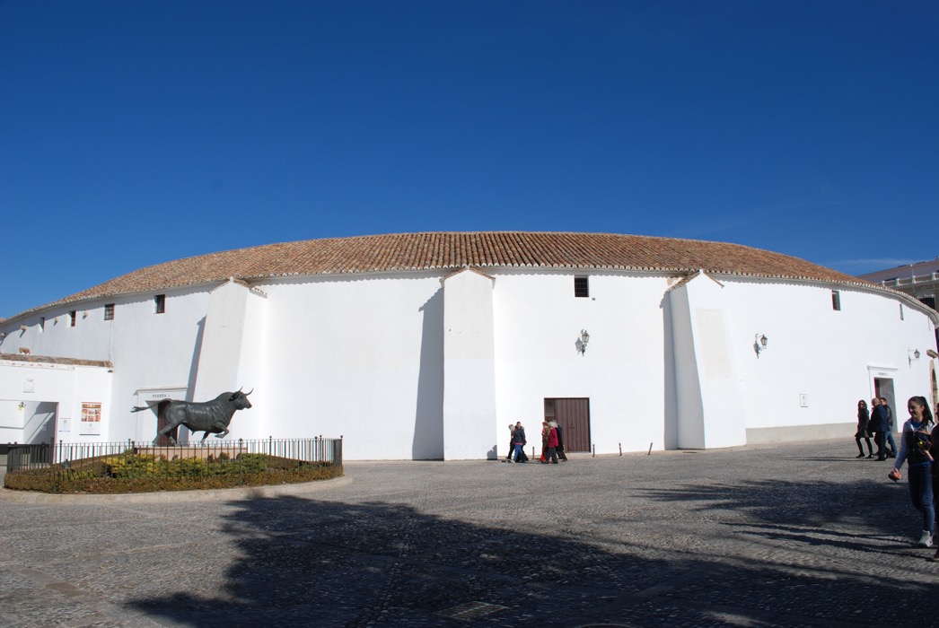
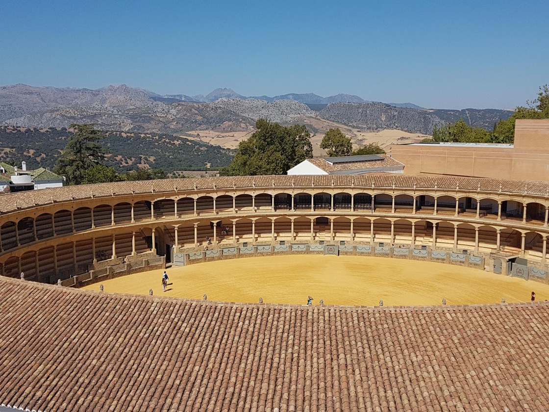
Very near the 'Alameda del Tajo' there is the Plaza de Toros, one of the most important monuments that represents both Ronda and Andalucia.
And finally near the Plaza de Toros and the Alameda del Tajo, we have the most famous symbol of Ronda, the Puente Nuevo.
You can check out my separate webpages on Bańos Árabes, Plaza de Toros and on Puente Nuevo.
A last word on geology
We started this webpage by looking at the geology of the Serranía de Ronda, and on our introductory page to Ronda we also mentioned the Parque Natural de la Sierra de Grazalema. In 1984 this park was Andalucia's first natural park, and in 1977 it had already been declared a UNESCO Biosphere Reserve. These are marks of status, but they translate into places that provide a safe habitat for everything from cork oaks and wild olives to a variety of eagles and vultures.
But most people do not know that it is this area, with more than 2,000 mm per year per square metres, that has the highest rainfall regime in the entire Iberian Peninsula. The reason is simple, it's the first high area touched by the humid sea winds coming off the Atlantic. As the winds passover the Andalucían lowlands they warm up, and then they have to abruptly rise to passover the limestone peaks of the Sierra de Grazalema, they cool and condense, producing rain (the technical term is orographic precipitation). So, once and for all, the rain in Spain doesn't always stay on the plain.
Surprisingly the Sierra de Grazalema can suffer from drought. The region is calcareous, so the limestone is porous and the rain quickly disappears into underground channels, caves, rivers, and caverns. And the region being sunny, the ground surface quickly dries out.
Returning to the regions geology, we are going to have to introduce a few technical terms. There is something called mafic rock, where the name comes from the fact that it is igneous rock (i.e. cooled magma or lava) that is rich in magnesium (thus the 'ma') and iron ('fic' is the latin word for iron). There is also something called ultramafic rock, which as one might guess, is a rock containing a lot of mafic rock, thus having a very high magnesium and iron content, and a correspondingly low silica content. What's important is that the Earth's mantle is composed of ultramafic rock. The mantle sits between the Earth's crust and the Earth's core. Whilst the mantle makes up 84% of the Earth's volume, its the crust that makes up the first 30-50 km below our feet. And that crust is usually made up felsic rocks, a word made up from feldspar and silica. The Earth's mantle is in fact divided into different layers, and the uppermost is called the lithospheric mantle. This layer is famous for tectonic activity, where the movement of huge slabs of the Earth's surface are responsible for some of the most dramatic geological events, e.g. earthquakes, volcanoes, etc.
The whole point of this final little section is to note that the Serranía de Ronda is the world's largest outcrop of mafic and ultramafic rocks, and corresponds to a layer that was once beneath an ancient continent. The rock has been dated to about 1.2 Gigayears (i.e. billion years before present). This specific outcrop of rock is interesting for both the petrological processes they preserve but also for their metallogeny that is unique in the world. What does this mean in practice?
The idea is that during the Earth's formation and evolution it is supposed that there were repeated cycle of melting, where magmas rose to the crust, and then were mixed back into the convecting mantle to be stored deeper in the Earth. What better way to study these ideas than to take samples from the mantle itself, and that is possible in the region of the Serranía de Ronda. It has a unique assemblage of magmatic ores, i.e. with Cr, Ni, Cu, platinum-group (with Os, Ir, Ru, Rh, Pt, and Pb), as well as Au. So the Serranía de Ronda is an important resource in looking into the Earth's early geology, and one day it may also prove valuable as a new resource for noble metals.
Beyond this level of description one enters a magma of specialist concepts and jargon, which is a good enough reason to close this webpage here.