Phuket - Khao Phing Kan
last update: 09 May 2020
Our New Year trip for 2020 ran from late January 2020 to mid-March 2020 and involved 8 nights in Dubai and 43 nights in Phuket.
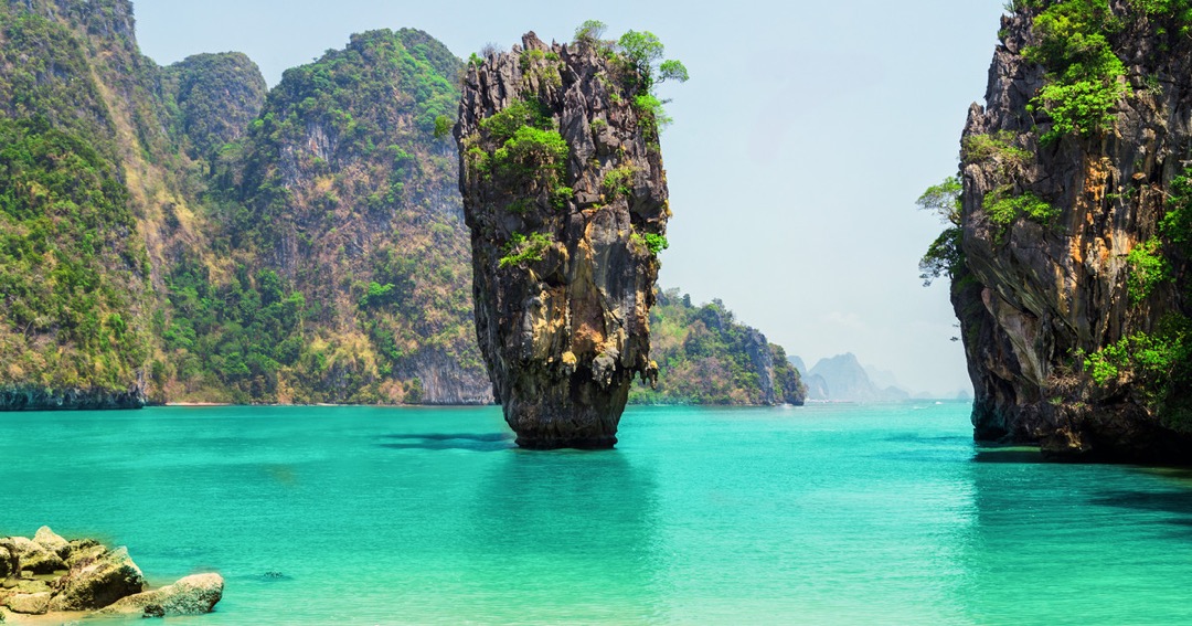
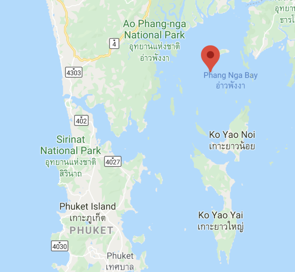
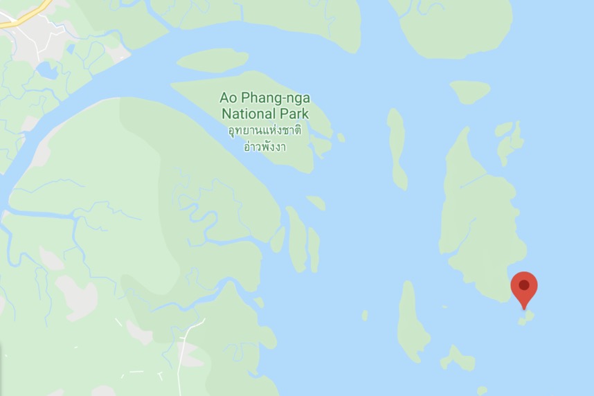
When in Phuket, one of the obligatory trips is to visit Khao Phing Kan. This is a very small island in the Phang Nga Bay, which is actually northeast of the northern most part of Phuket. Sitting just a few metres from this rock mass is the famous islet Ko Ta Pu, otherwise known as the James Bond Island.
The islet is part of a group of 42 islands that are included in the Ao Phang Nga National Park.
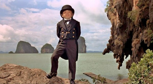
The James Bond Island is in fact a sea stack attached to one of the islands in the park. Wikipedia tells us that it became a popular tourist destination after it had appeared as the villains hideout in the 1974 James Bond film "The Man with the Golden Gun".
Oddly, I only remember three things about this film. The first is that it was one of the poorest of the batch, and secondly there was a ridiculous shootout between the villain and 007.
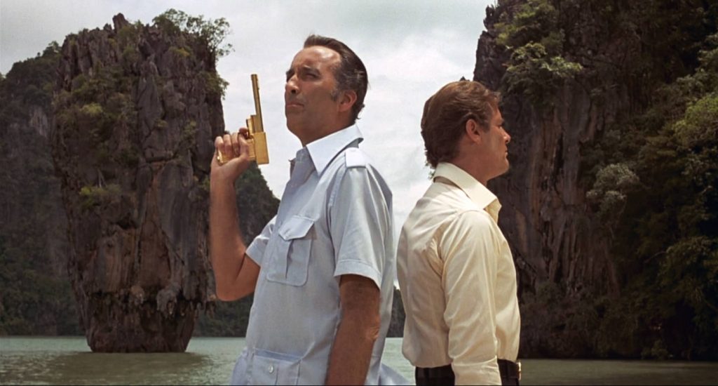
The third thing I remember was that the only redeeming feature of the film was the villains sidekick, the baddie Hervé Villechaize.
How to get to the James Bond Island?
There are two ways to visit the island. The first is to book a speedboat trip from Phuket, and the second is to drive to Ao Phang Nga National Park and take a much shorter boat trip.
The boat trip from Phuket Marina takes about 7-8 hours and usually includes some cave exploration, sea canoeing, etc. Much depends on which marina is used in Phuket, but the James Bond Island is about 80 kilometres away from Phuket.
On the other hand, the drive to the National Park is around 90 minutes or more, starting from the Bang Tao Beach area. Naturally it would taken longer from Patong Beach or Phuket Town (but it would also take longer to get to the marina).
I can't really evaluate the pro's and con's of each option, so the best thing is to describe our trip and let the reader decide.
We took a private trip just for my wife and myself, and we decided to go with a guide who organised the entire day out. So our day included:-
Pick-up at our hotel in Bang Tao at 06:00
Go to Ao Phang Nga National Park and take a 'long-tail boat' to the James Bond Island
Sea-cave canoe (optional)
Visit the village Koh Panyee for lunch
Visit Mangroves
Visit Suwan Kukha Temple
Drop-off at hotel
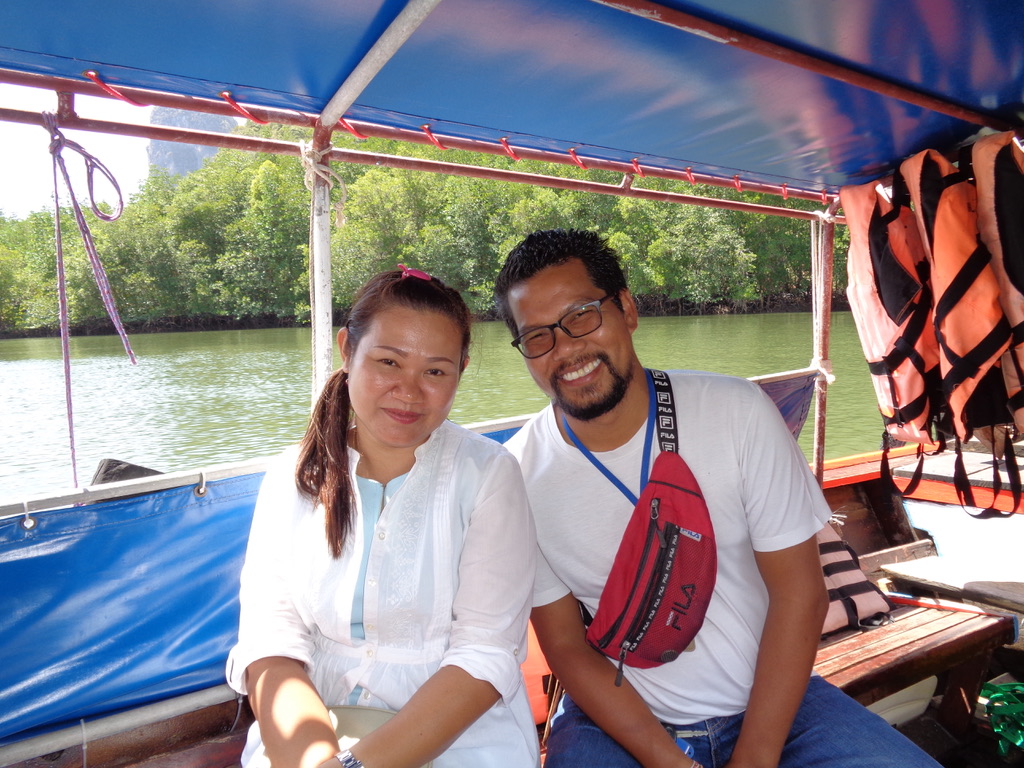
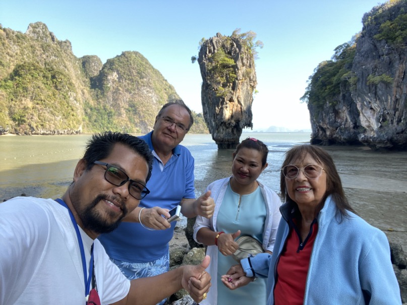
Our guide was William Suwanchatree (www.khaolakprivatetravel.com) who had been recommended by someone we knew at home.
This is certainly not the cheapest option, but in our opinion it was well worth the expense.
Hotel pick-up
A driver picked us up at our hotel at 06:00. She was driving what looked to be a 2018 Toyota HiAce GL Grandia AT with lots of extras and a custom interior (not crazy but still customised with designer padding and etched plastic reflecting panels, etc.). The interior was in immaculate condition, and it looked almost new. And naturally it was fully equipped with a dashcam and two Buddhas in their small plastic domes sitting on top of the dashboard.
The minibus, which provided the pick-up and drop-off service for us, came from a boutique guesthouse called PapaCrab in Phuket. This 3-star guesthouse has been called 'rustic-chic' and is on Kamala Bay, a quiet area just north of Patong. Kamala Beach is said to be one of the most beautiful places on Phuket, and a favoured spot for retirees staying long-term in small hotels and apartment rentals.
The drive from our hotel to Ao Phang Nga National Park took nearly 2 hours, but we stopped in a 7-Eleven for a breakfast of coffee and Snickers (for a very reasonable 47 Baht or about €1:40).
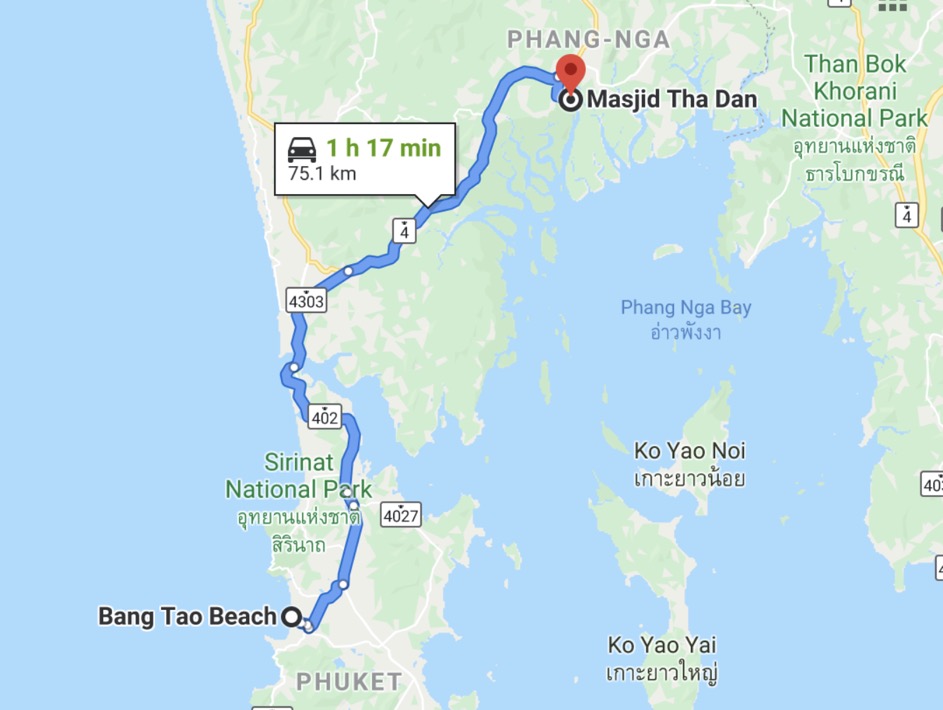
Our exact destination was Masjid Tha Dan, and just before arriving there on the 4144 there is an exit to the Ao Phang Nga National Park.
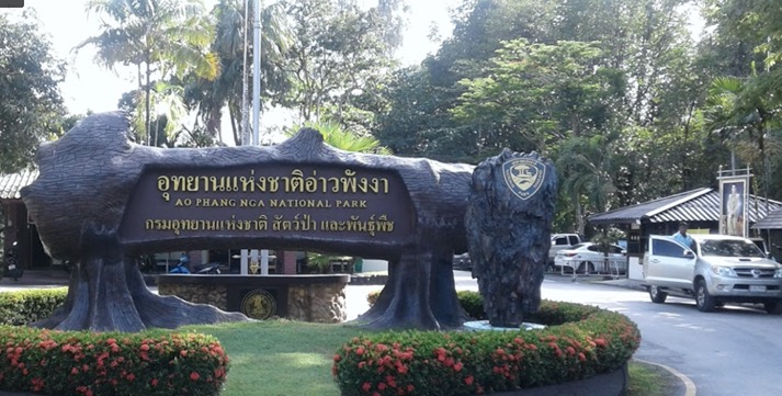
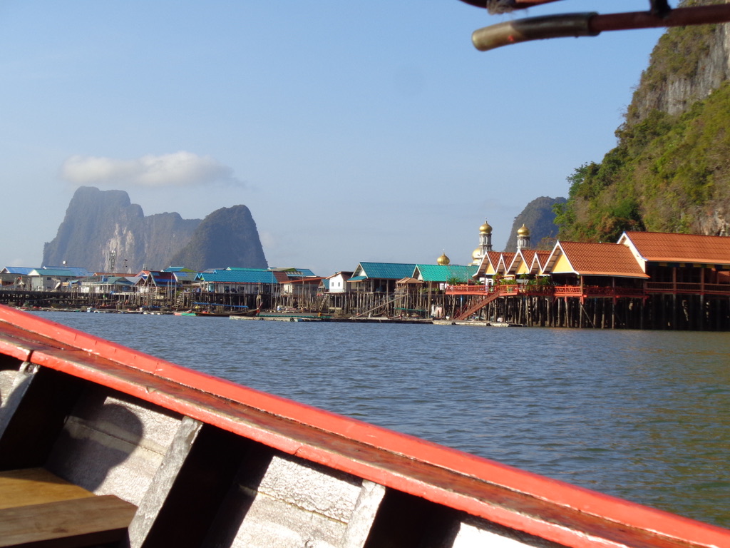
And all we had to do was drive down to the riverside of the Ko Pan Yi. That's the name on Google maps, and it obviously echo's Ko Panyi, the name of the Muslim fishing village on stilts that sits at the mouth of the river.
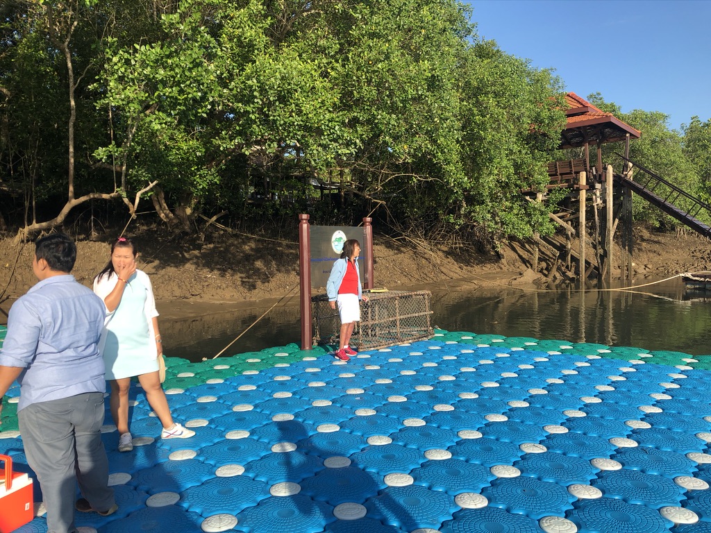
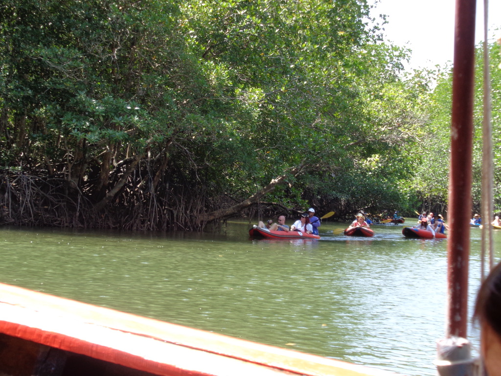
It is on the riverside that we met our guide and his wife, who would also accompany us on our tour. The first 'task' was to board our boat. Even that was a challenge! Firstly the foundations of the path to the river had clearly shifted with time, then we had a steep drop to the river because the tide was out.
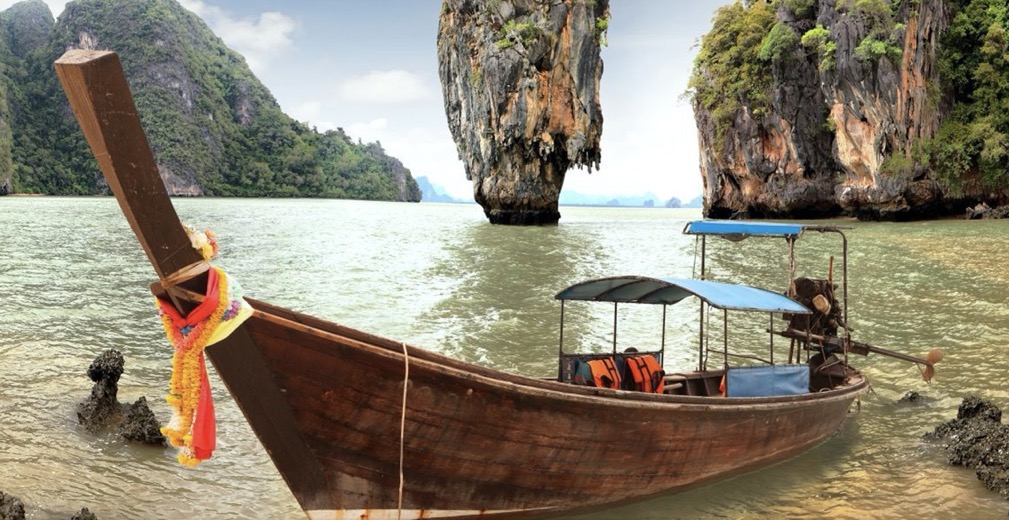
So finally we are on the floating dock (Monique looks hesitant and is grabbing on to something just in case), and we can see our traditional long-tail boat arriving.

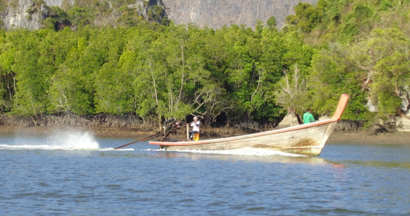
The Wikipedia article on the traditional long-tail boat mentions that there are a variety of different designs, but all have a secondhand car or truck motor as a powerplant. The same basic design can range from one-man racers through to people carriers.
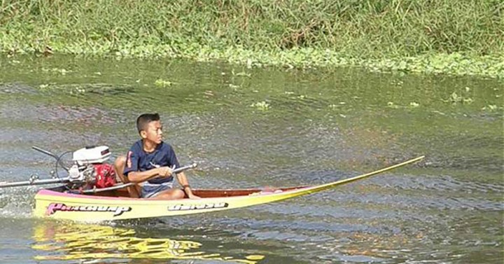
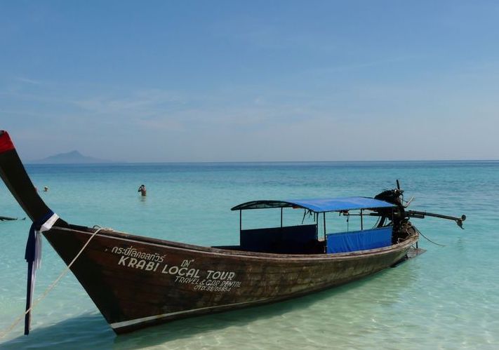
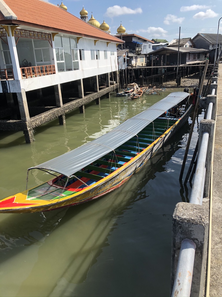
Wooden boats with motors and rudders were relatively common in Thailand, but they were slowly being replaced by the car and above all scooters and motorbikes. However, as the price and complexity of vehicles increased so the Thai long-tail boat saw a resurgence. The hull was designed to have a v-shape at the bow and a flat-bottom shape amidships. The design proved to work well with the addition of a small engine. People have found that the long-tail boat is a speedy multi-purpose boat which is both easy to make and maintain, and it usually mounts a secondhand water-cooled engine. You can't use sea water for cooling, but there are ways to get around that problem. And there are solutions for gear changing, coupling the drive shaft to the propeller, and steering. The report on the "Thai Longtail Boat" dates from 2001, but it does a good job covering the essentials on the engine, cooling, transmissions gears, the tiller and control lever, etc.
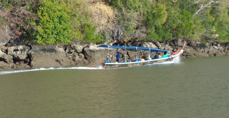
As we set out early in the morning (about 08:30) it's important to realise that the tide is out and the river delta we are travelling towards is only a couple of metres deep. In fact part of the skill of the local fishermen is to avoid the mud banks. The type of motor, and in fact the entire design of the long-tail boat, is for very shallow waters. You can often see mention of similar designed boats as 'mud motors'.
On our way to the James Bond Island
We first passed the small riverside village of Masjid Tha Dan and then the Andaman Centre for Research in Fine Arts. At the mouth of the river we found the Koh Panyee village, which we would visit on our return trip. As we travelled towards the village we could see just how the river was like any main road - carrying people, bring goods into the village, fishermen returning from the morning catch, etc.
Below we can see Ko Panyee, a village entirely built on stilts. Originally built by nomadic Malay fishermen, it is now home to around 360 Muslim families originally from Java. We will lunch in the restaurant on the far right.
Full speed ahead to James Bond Island
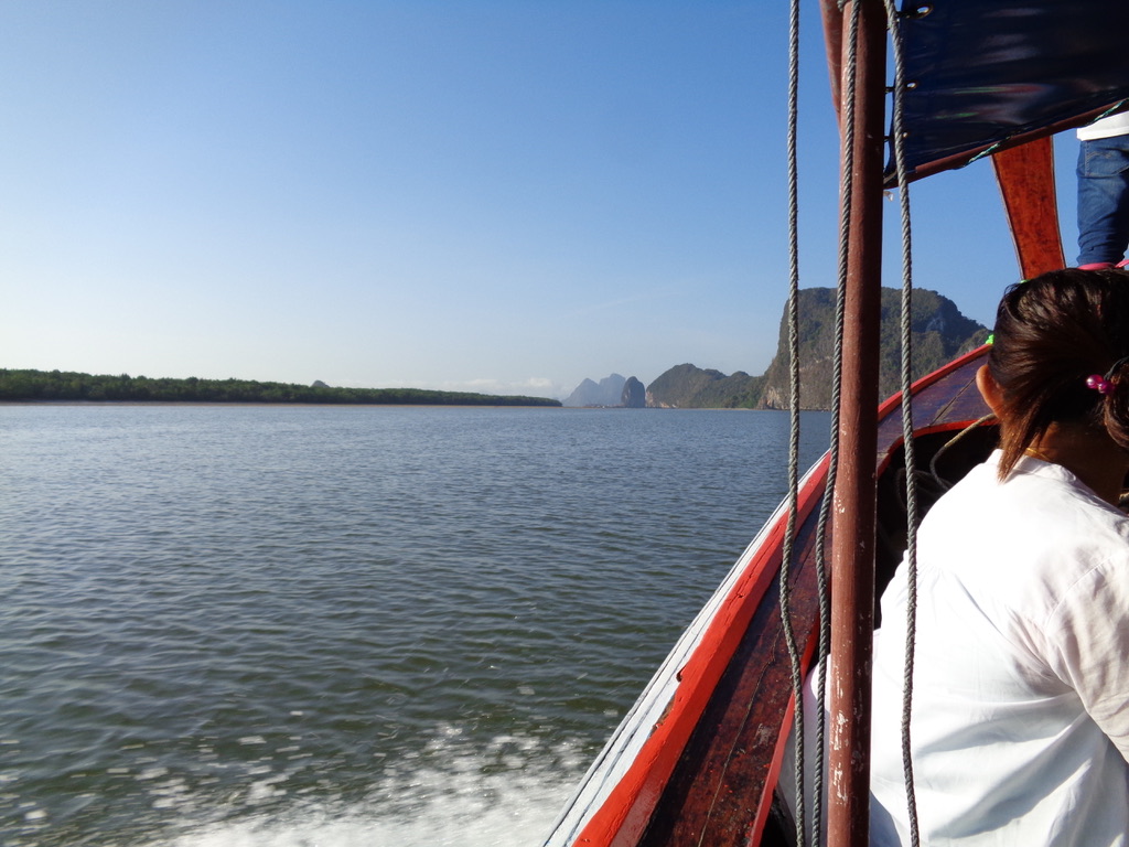
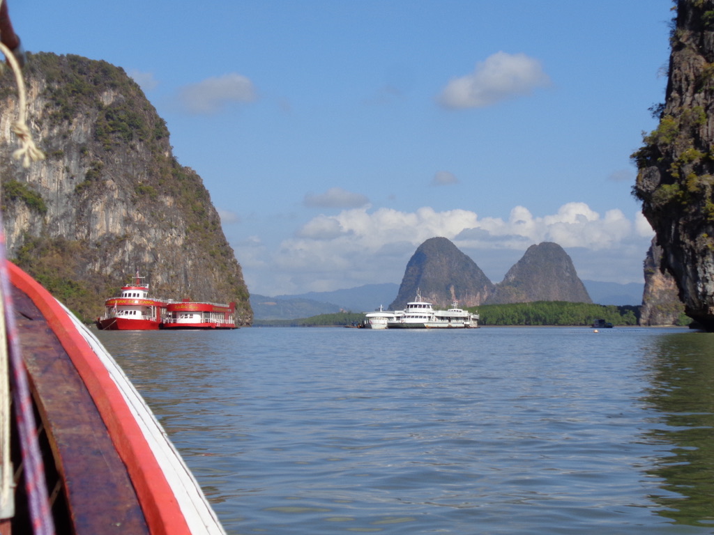
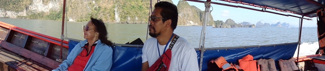
As we move away from the mouth of the Ko Pan Yi and the village Ko Panyee (or Ko Panyi) we being to see the islands of rock standing out in the sea.
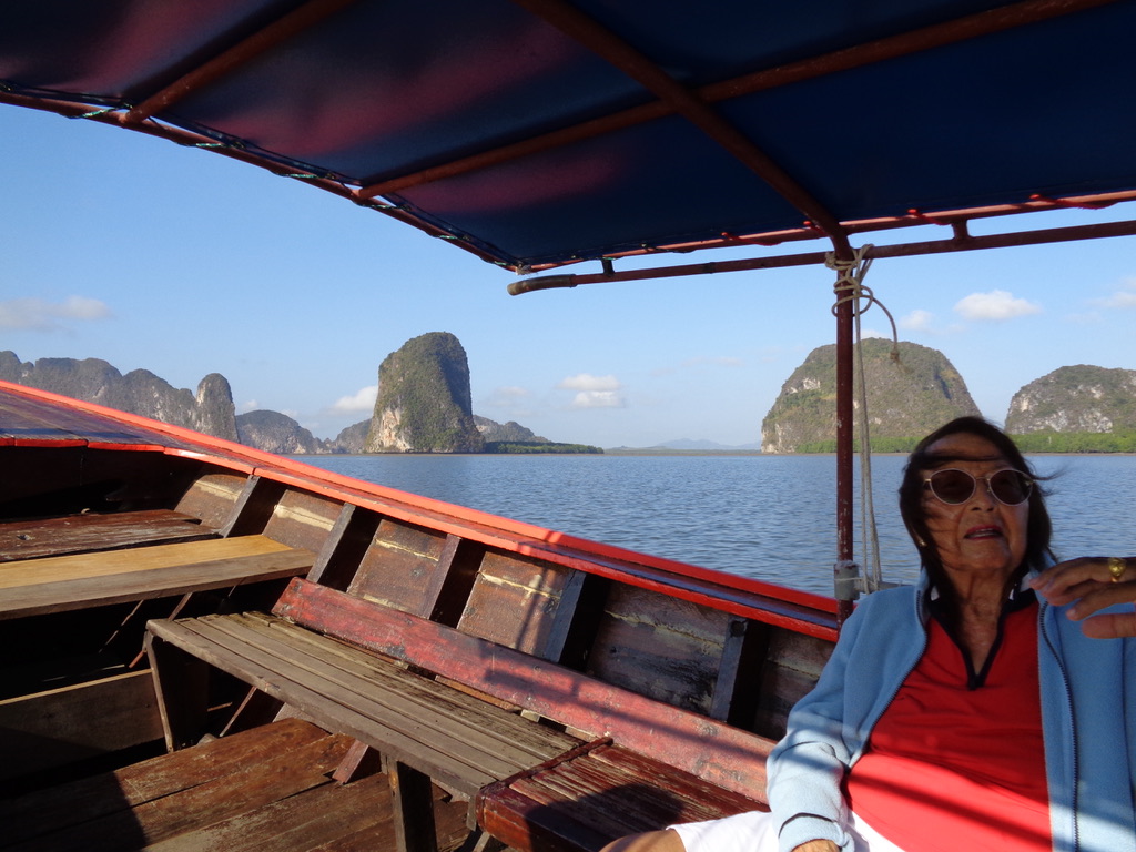
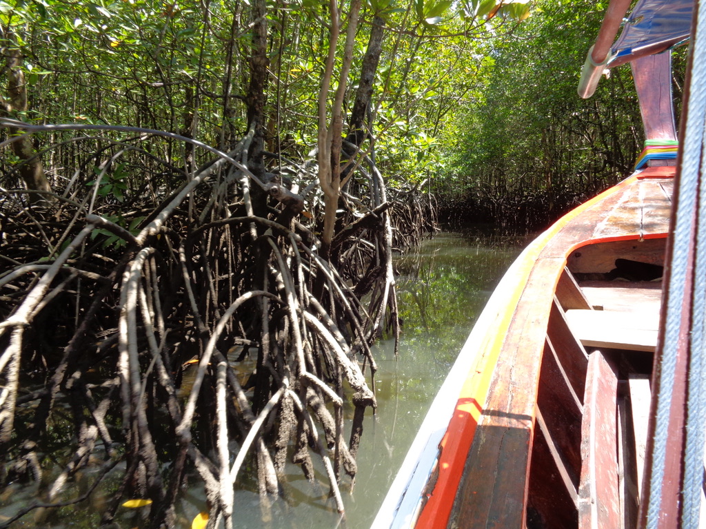
The technical name for these islands are karst towers. This type of feature is formed on a limestone bedrock that was subject to sustained erosion by water. The erosion can take many forms, but in this case what we see are towers arising from alluvial plains. The reality is that these karst towers are found all over Southeast Asia, but they have not all been formed by exactly the same physical processes, i.e. the limestone was formed at different times in the past. For example, most of the karst in Myanmar and Thailand date from the Palaeozoic age, i.e. between 240 and 550 million years ago. We can only see these karst towers, but the reality is that about 15-20% of Thailand is sitting on limestone of variable purity and age. In the entire region of Phang-Nga-Krabi the karst landscape is dominated by poljes (flat plains) draining through strike ridges (e.g. ridges and dips or slopes) or around isolated limestone towers. Caves are formed when allogenic streams run across alluvium before sinking into the bases of the ridges and towers. This just means that the water coming from another area is strong enough to cut its way through the flat plains in order to reach the open sea.
In the Phang-Nega bay the towers continue into the sea, and caves can even be traversed by boats. Even today the seasonally heavy rains will drain a large quality of water through the underground caves and can result in the collapse of large blocks and towers. For more information check out "Karst in Southeast Asia", and "Thai Geological Site" does a great job in describing the amazing and varied geology of the country.
Frankly I found it very difficult to determine what was an island and what was not, and what their various names were.
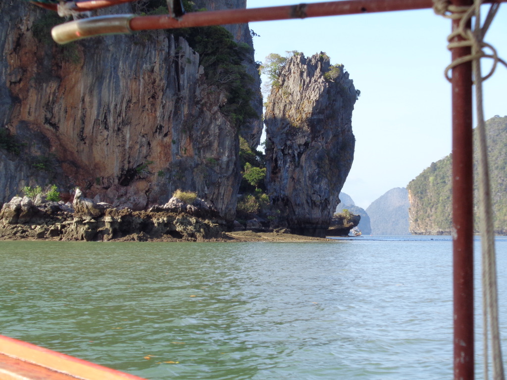
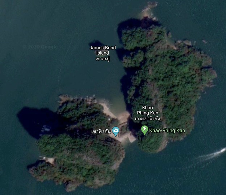
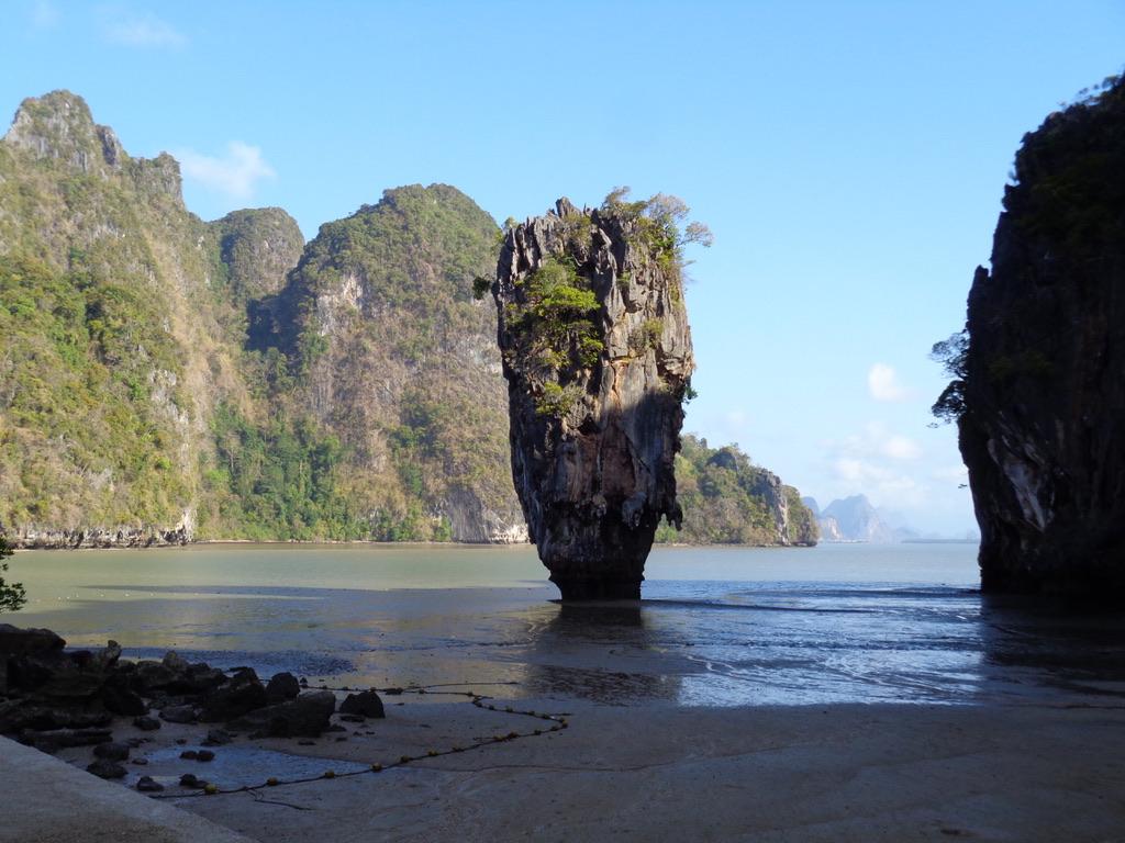
But at one moment in time we sighted our destination, the James Bond Island. We can just see a slight separation between the rock mass on the left and a smaller isolated rock stack. The larger mass is part of the island called Khao Phing Kan, and that smaller rock stack is called Ko Ta Pu, otherwise known as the James Bond Island.
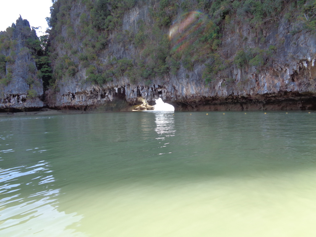
You may have seen photographs of an individual long-tail boat pulled up in front the famous rock, but now that is no longer possible.
Today no boats are allowed to approach the James Bond Island or to enter the small bay. Experts have clearly identified that the turbulence of the propellers increases the erosion of the foot of the stack. On top of that, with the tide out the stack is actually almost sitting out of the water.
We will now touch on a second problem. You may have wondered why we started out our visit at 06:00 in the morning. We were on our long-tail boat at about 08:30, and we arrived at the James Bond Island at about 09:15 and stayed there until just before 10:00.
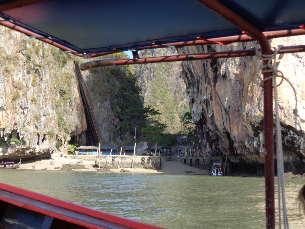
Around the back of island there is a small landing area. Even at 09:15 you can see that there was a small motorboat and another long-tail boat. We were able to beach our boat, and there were people with solid steps that helped everyone disembark. You could walk right through the landing area and have a clear view of the famous James Bond Island.
When we arrived on the island there were perhaps 10-15 people, when we left the island 30 minutes later there were perhaps 50 people on the island. By then the boats had to disembark their visitors and then pull out to let other boats access the beach area. Our long-tail boat came back in, we embarked, and then we were off.
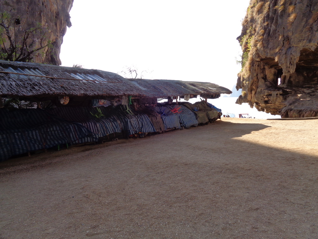
We were told that about 10,000 people a day visit the island. Even if this may be an exaggeration, it nevertheless highlights the fact that come mid-day the place is totally overcrowded. Below we can see that we were (fortunately) too early for the stalls selling souvenirs, food, drink, etc.
Later in the day as we made our way back to the Ao Phang Nga National Park site we could see a constant stream of long-tail boats all carrying tourists to see the James Bond Island.
Kayaking, no thank you …
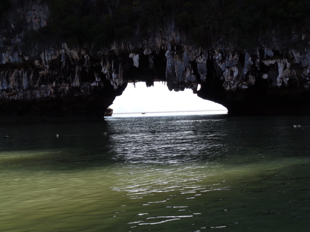
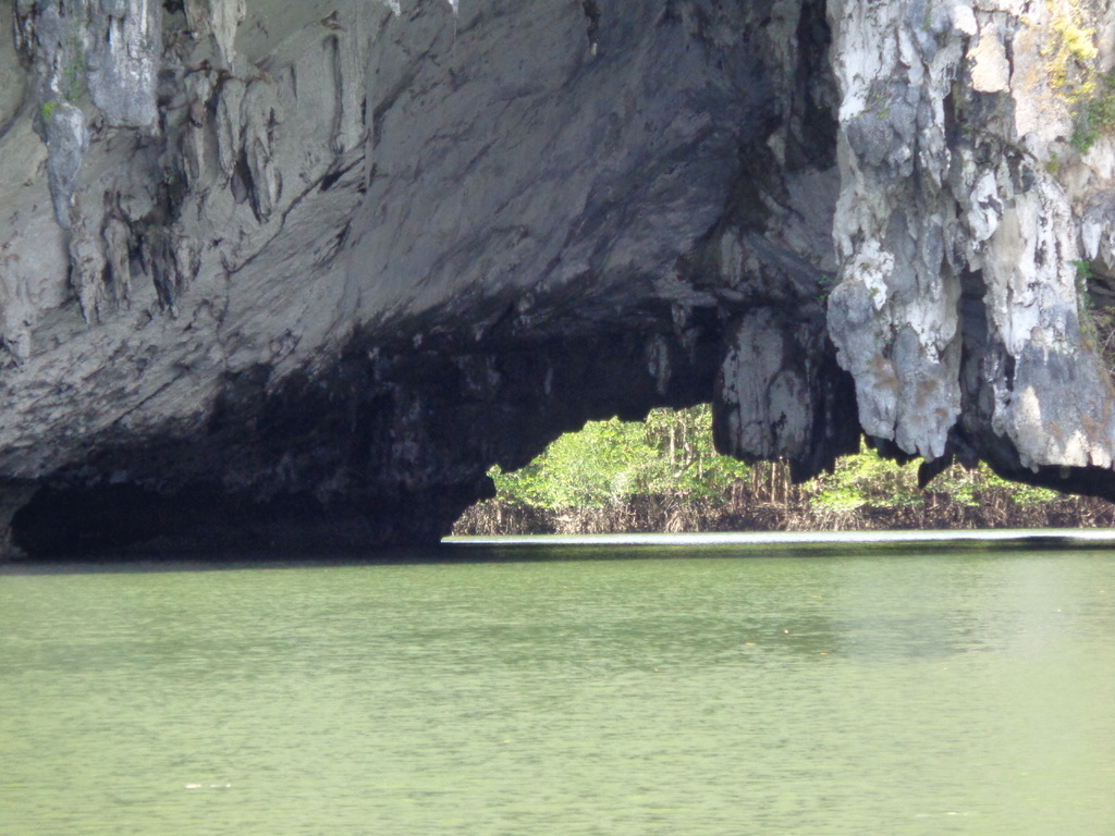
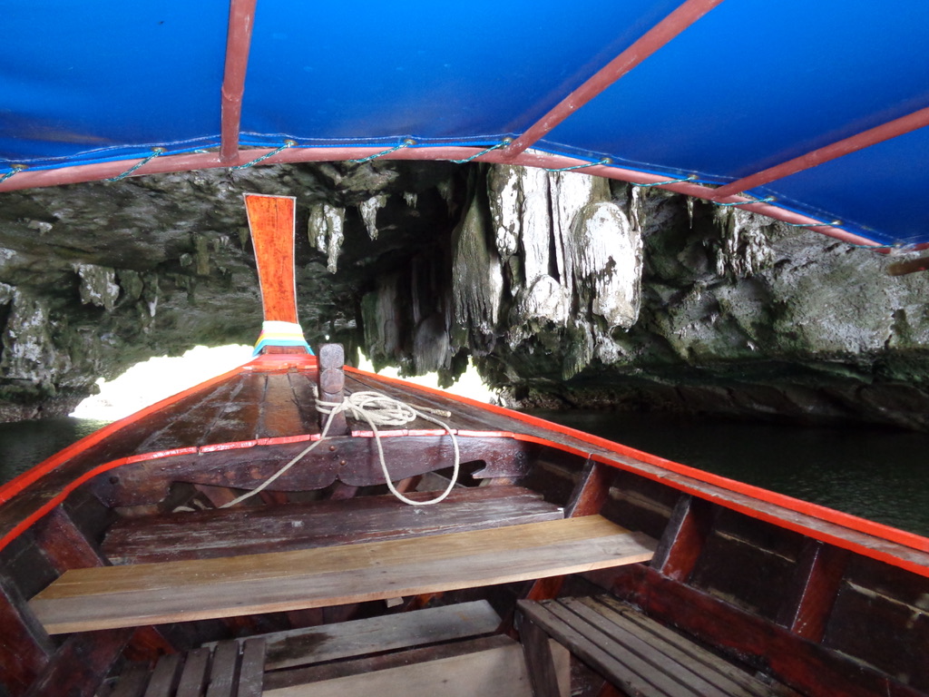
Part of our day out included a kayaking trip, but we decided to not take up that option. However, this did not stop us having a look at the place and the cave that would have been our playground.
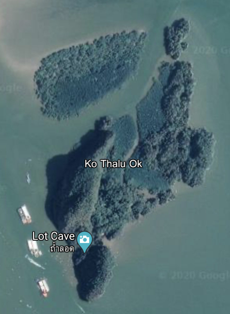
So our next stop was the island of Ko Thalu Ok and the so-called Lot Cave. As far as I can see there is a lot of confusion about the name of the island and the cave, with different references and photographs being posted on the Web. There are clearly other places with the same names.
You can see that 'our' island of Ko That Ok is permanently occupied by the kayaking (or 'seaconoeing') companies. There are at least three big groups installed near the Lot Cave. Each consists of a boat, plus a kind of large 'raft' that operates as a covered harbour for all the canoes.
And below we can see what all the fuss is about. The cave is said to be about 50 metres wide and 40 metres high, and you can pass with a small boat. Personally I don't believe those figures, and our long-tail said he have never seen anyone go through the cave on a boat.
Lunch at Koh Panyee
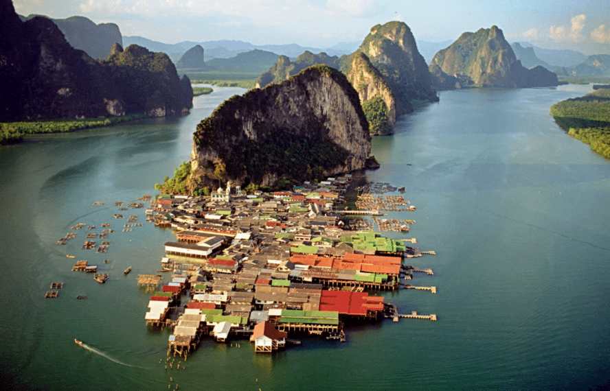
The next part of our day long trip was to stop for lunch at Koh Panyee (or Ko Panyi). The Wikipedia article is well worth reading, because it provides some social insight into life on the floating island.
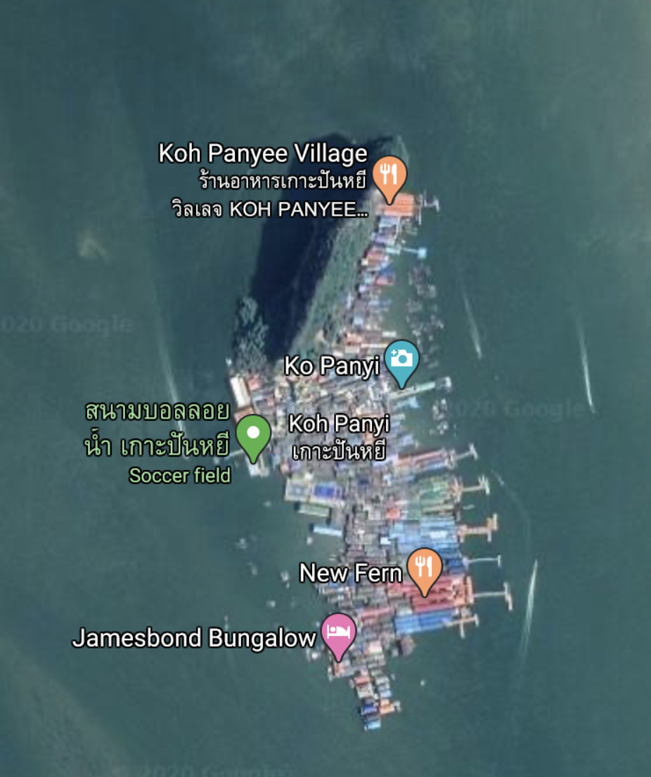
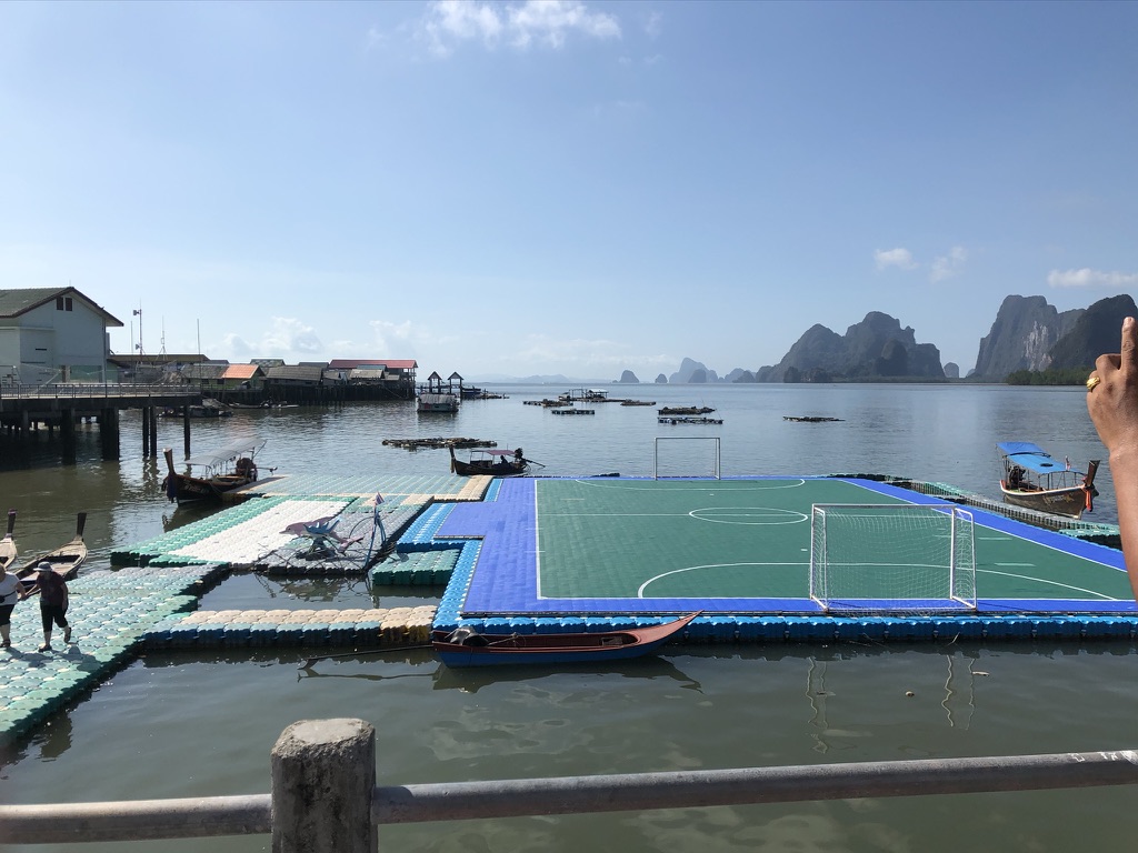
We would disembark next to the soccer field, and then walk through the village to the restaurant indicated at the Koh Panyee Village label. We would then embark again on the jetty attached to the restaurant.
Our guide told us that the village was now receiving government funding for the mosque, the school, the football pitch, etc. and that with the 1,000's of daily visitors the inhabitants were able to stay on the island.
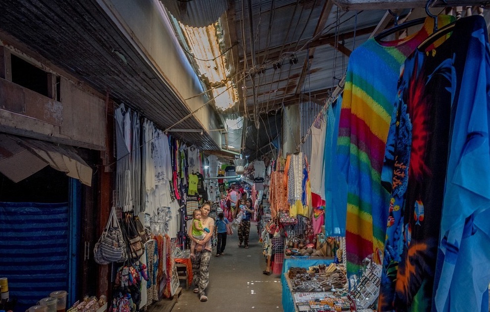
To get from the floating football pitch to the restaurant we walked through a labyrinth of what were small stands and shops selling a wide variety of trinkets, souvenirs, clothes, foods, etc. all designed for the unsuspecting tourist. The reality is that nothing is made in the village except a few basic food products based upon fish. Everything is imported for the tourist.
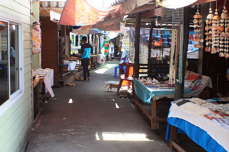
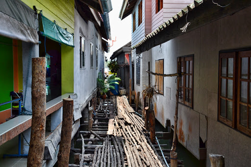
There are not many photographs of the labyrinth of shops, etc., and some of them tend to over-romanticise the experience. The village would have been originally built on wooden poles, but now increasingly you could see that they were using reinforced concrete columns as structural supports. The path we took through the village was entirely cemented, but all the side branches, etc. were still covered in wooden planks. The tide was out when we visited, and we could see the mud floor about 4 metres below. We were told that when the tide is in there is about 2 metres or 2.5 metres of water, although a few times a year it can reach the level of the concrete path.
The state of the structures visible along the path varied enormously. Some looked to be proper shops with raised floors, full of merchandise, and with a second floor living space. Others are no more that a few trays on a trellis table, set against a ramshackled wood hut. Here and there a building had clearly collapsed and not yet been reconstructed. We did see one shop being rebuilt and workers filling new concrete stilts.
I think the above photograph captures best what we saw. In fact, as we were very early, we did not attract much attention. And I fully understand the argument of our guide. We spent 200 Baht on some caramelised food stuffs, and if every visitor every day does the same, the villagers must actually live better than many other Thais in the region.
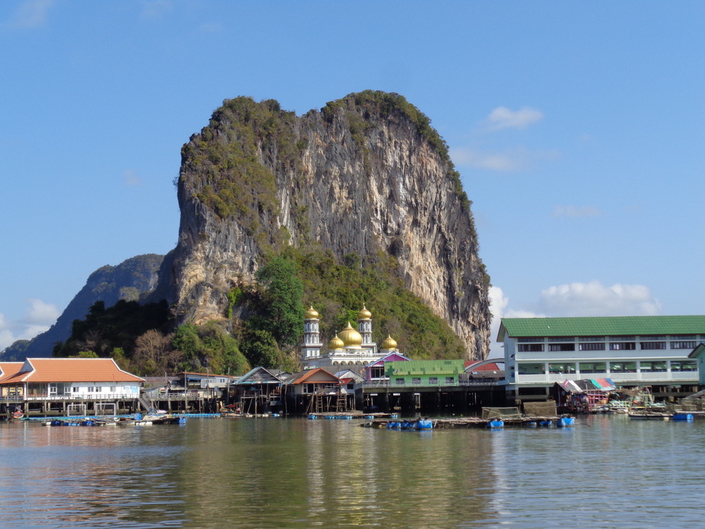
Finally we arrived at our restaurant. A very large and well built structure at one end of the island. Completely built in wood with very solid tables and chairs. The food was well prepared and very tasty.
The restaurant was virtually empty, except for a group of 8 tourists, however all the tables were set for different pre-reserved tourist groups. And our guide told us that at mid-day it would start to fill up.
The mangroves
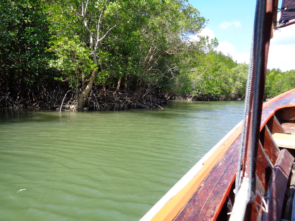
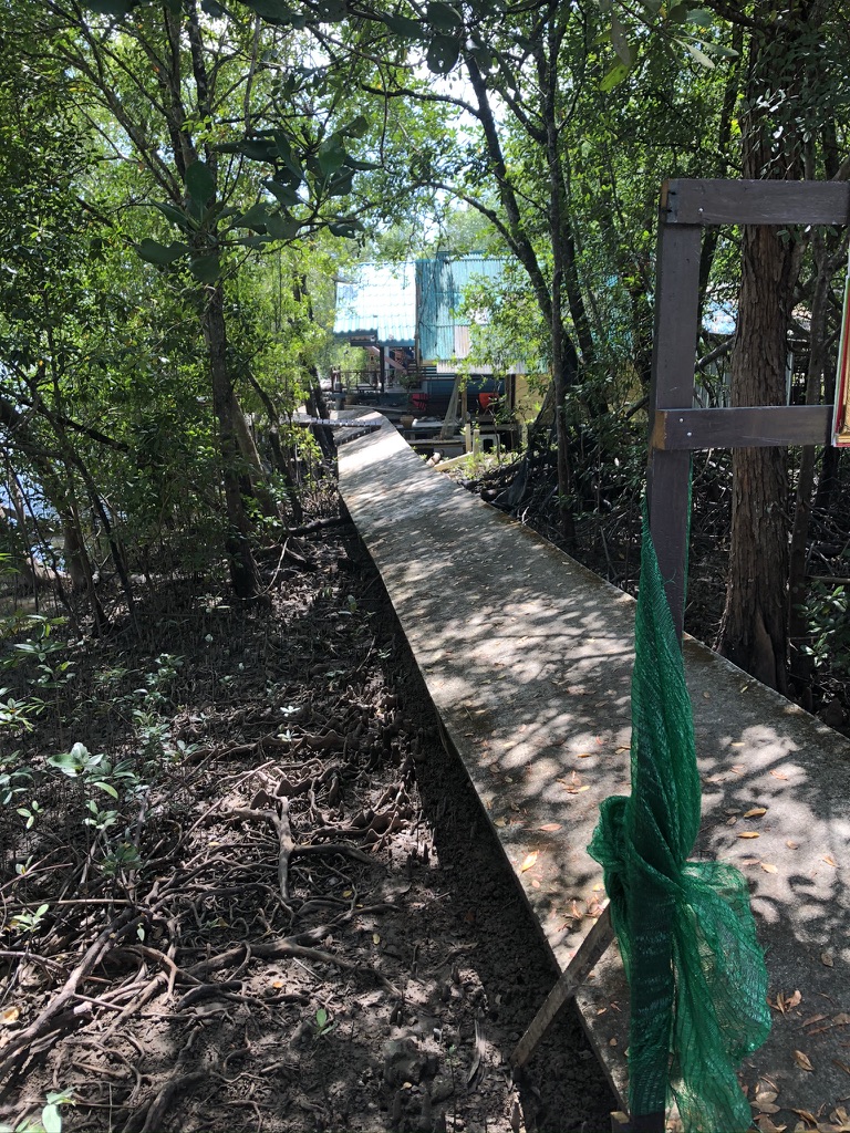
The next part of our tour was to make our way back through the mangroves. Initially our trip took us to another cave where we met a kayak group. Unfortunately I don't know what this cave was called and where it was situated exactly. In the mangroves you can quickly lose you orientation and get lost.
The second part of our trip through the mangroves was using very small passageways to return to the river Ko Pan Yi and the Ao Phang Nga National Park entrance.
Mangroves are just shrubs and small trees that grow in costal saline or brackish water. So they are halophytes, or salt-tolerant plants, that have also adapted to the low oxygen conditions of waterlogged mud. According to the UN, costal mangroves are among the most threatened ecosystems on earth, and in Thailand the loss of the costal habitat with mangrove deforestation has resulted in a decline in fishery resources. This deforestation is not only driven by tourism, but also thousands of hectares of mangrove forests have been cleared to make room for shrimp aquaculture. Some experts claim that Thailand had already lost more than 50% of its natural mangrove forests.
Today we understand better how mangroves, with their massive root systems, dissipate wave energy and promote sediment buildup in tidal areas. They are now seen as a natural way to protect seagrass beds and coral reefs. If you want to know more about Thailand's mangrove forests check out "Mangrove Forests in Thailand".
And back out on the open river we were able to speed back to our point of departure.
Wat Suwan Kukha
Our final stop was to the temple of Suwan Kukha ('wat' means 'enclosure' and is often used to refer to a Buddhist temple).
Conclusion
To close this webpage on our visit to James Bond Island, it only remains for us to thank our guide William and his wife for organising a truly interesting tour.